Ben Lomond night lights from space
Night Light of Ben Lomond (California) from space (United States) Src. Average luminocity for 10x10km area is 4.9388% and for 50x50km: 11.0585%.
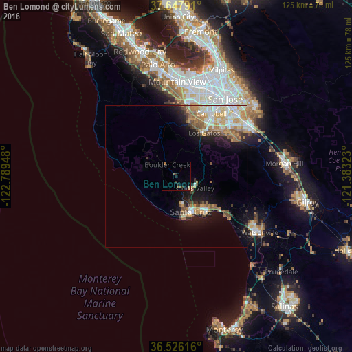
Analysis of Ben Lomond night lights 2016
Square area 10x10 km:
 0%
0%90-99
0%80-89
0.85%70-79
1.02%60-69
1.02%50-59
1.36%40-49
0%30-39
1.7%20-29
1.36%10-19
0.51%0-9
92.18%Square area 50x50 km:
1.39%90-99
2.06%80-89
1.25%70-79
2.24%60-69
2.06%50-59
1.64%40-49
1.31%30-39
0.8%20-29
1.59%10-19
6.07%0-9
79.6%Clear (daylight) street map image can be seen on geolist.org.
Map coordinates:
37° 38' 52.5" North, 122° 47' 22.1" West
37° 5' 20.8" North, 122° 5' 10.9" West
36° 31' 34.2" North, 121° 22' 59.6" West
Some cities around Ben Lomond sort by population:
• Santa Cruz
13.7 km =8.5 mi,  158°
158°
• Saratoga
20.2 km =12.6 mi,  16°
16°
• Los Gatos
18.2 km =11.3 mi,  32°
32°
• Live Oak
15 km =9.3 mi,  141°
141°
• Scotts Valley
7.6 km =4.7 mi,  123°
123°
• Capitola
17.3 km =10.7 mi, 136°
• Soquel
16.1 km =10 mi,  134°
134°
• Aptos
20.7 km =12.9 mi, 126°
5327522 (p: 6,234)
Sources (retrieved 2019-11-25):
» Earth at Night: Flat Maps 2012, 2016