Camas night lights from space
Night Light of Camas (Washington) from space (United States) Src. Average luminocity for 10x10km area is 49.4364% and for 50x50km: 31.335%.
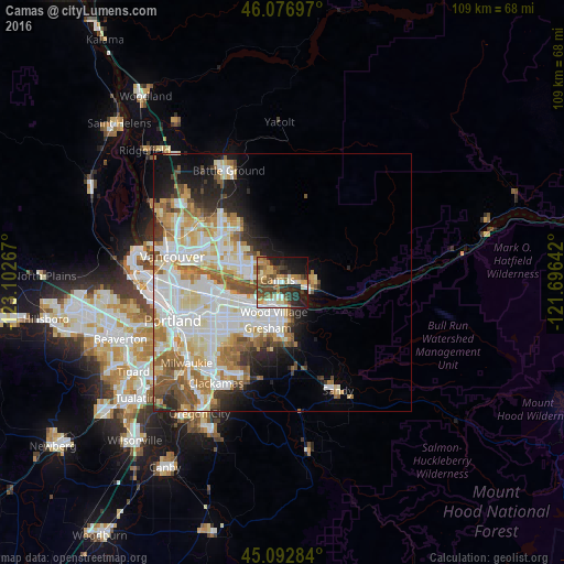
Analysis of Camas night lights 2016
Square area 10x10 km:
 6.67%
6.67%90-99
8.33%80-89
5.45%70-79
10.3%60-69
7.12%50-59
7.27%40-49
10.3%30-39
8.48%20-29
14.85%10-19
18.18%0-9
3.03%Square area 50x50 km:
7.92%90-99
8.59%80-89
3.9%70-79
3.91%60-69
4.03%50-59
3.74%40-49
2.82%30-39
1.91%20-29
3.94%10-19
6.36%0-9
52.88%Clear (daylight) street map image can be seen on geolist.org.
Map coordinates:
46° 4' 37.1" North, 123° 6' 9.6" West
45° 35' 13.4" North, 122° 23' 58.3" West
45° 5' 34.2" North, 121° 41' 47.1" West
Some cities around Camas sort by population:
• Gresham
10.2 km =6.3 mi,  194°
194°
• Lents
17.7 km =11 mi,  227°
227°
• Orchards
15.3 km =9.5 mi,  305°
305°
• Five Corners
17.4 km =10.8 mi, 308°
• Troutdale
5.4 km =3.4 mi,  169°
169°
• Washougal
3.6 km =2.2 mi,  97°
97°
• Fairview
6 km =3.7 mi,  206°
206°
• Mill Plain
9.6 km =6 mi, 310°
5788822 (p: 21,846)
Sources (retrieved 2019-11-25):
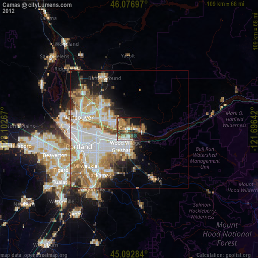
» Earth at Night: Flat Maps 2012, 2016