Gresham night lights from space
Night Light of Gresham (Oregon) from space (United States) Src. Average luminocity for 10x10km area is 65.4079% and for 50x50km: 33.5254%.
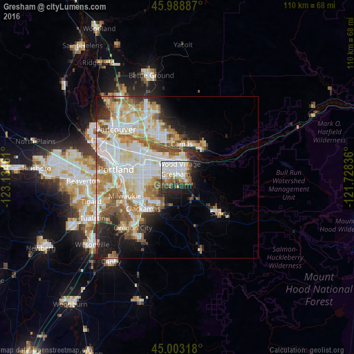
Analysis of Gresham night lights 2016
Square area 10x10 km:
 19.52%
90-99
18.1%80-89
6.19%70-79
4.92%60-69
8.89%50-59
7.78%40-49
7.14%30-39
6.83%20-29
11.9%10-19
8.25%0-9
0.48%Square area 50x50 km:
8.49%90-99
9.06%80-89
4.05%70-79
4.11%60-69
4.66%50-59
4.08%40-49
3.11%30-39
2.13%20-29
4.1%10-19
6.87%0-9
49.34%Clear (daylight) street map image can be seen on geolist.org.
Map coordinates:
45° 59' 19.9" North, 123° 8' 4.6" West
45° 29' 53.4" North, 122° 25' 53.3" West
45° 0' 11.4" North, 121° 43' 42.1" West
Some cities around Gresham sort by population:
• Camas
10.2 km =6.3 mi,  14°
14°
• Lents
10.8 km =6.7 mi,  259°
259°
• Happy Valley
9.6 km =6 mi,  233°
233°
• Troutdale
5.7 km =3.5 mi,  36°
36°
• Washougal
11.2 km =7 mi,  32°
32°
• Damascus
9.2 km =5.7 mi,  193°
193°
• Fairview
4.5 km =2.8 mi,  357°
357°
• Clackamas
14.8 km =9.2 mi, 227°
5729485 (p: 110,553)
Sources (retrieved 2019-11-25):
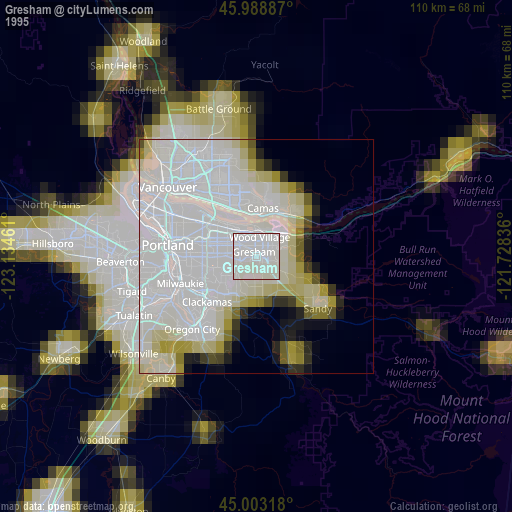
» NASA, Earths city lights 1995
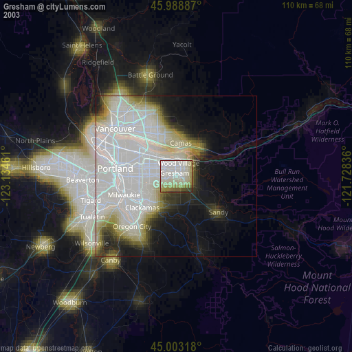
» NASA city lights 2003
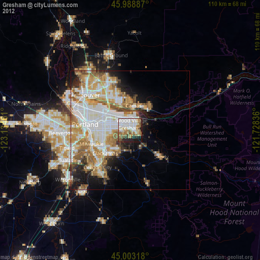
» Earth at Night: Flat Maps 2012, 2016