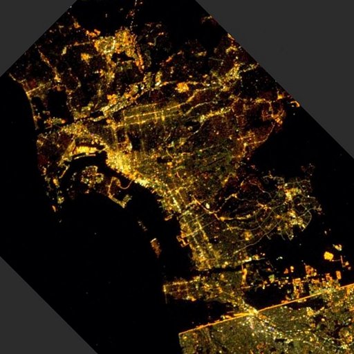
San Diego night lights from space
Night Light of San Diego (California) from space (United States) Src. Average luminocity for 10x10km area is 83.9021% and for 50x50km: 42.0718%.

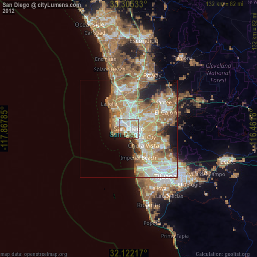
Analysis of San Diego night lights 2016
Square area 10x10 km:
 29.37%
90-99
28.32%80-89
11.01%70-79
5.94%60-69
12.06%50-59
5.07%40-49
1.05%30-39
2.1%20-29
4.72%10-19
0.35%0-9
0%Square area 50x50 km:
9.38%90-99
9.35%80-89
4.33%70-79
6.35%60-69
10.4%50-59
6.74%40-49
3.61%30-39
2.34%20-29
4.72%10-19
6.68%0-9
36.09%Clear (daylight) street map image can be seen on geolist.org.
Map coordinates:
33° 18' 19.2" North, 117° 52' 4.3" West
32° 42' 56.6" North, 117° 9' 53" West
32° 7' 19.8" North, 116° 27' 41.8" West
Fantastic image of San Diego from space taken by astronauts [src2], but I don't have information about it's orientation, scale or angle. If necessary, it was rotated manually, so North points approximately to upper direction. Click to zoom in:
Some cities around San Diego sort by population:
• Chula Vista
11.3 km =7 mi,  138°
138°
• National City
7.4 km =4.6 mi,  124°
124°
• La Mesa
14.5 km =9 mi,  66°
66°
• La Presa
15.7 km =9.8 mi,  93°
93°
• Imperial Beach
15.4 km =9.6 mi,  161°
161°
• Lemon Grove
12.8 km =8 mi,  76°
76°
• Coronado
3.7 km =2.3 mi,  207°
207°
• Bonita
14.2 km =8.8 mi, 117°
5391811 (p: 1,394,928)
Sources (retrieved 2019-11-25):
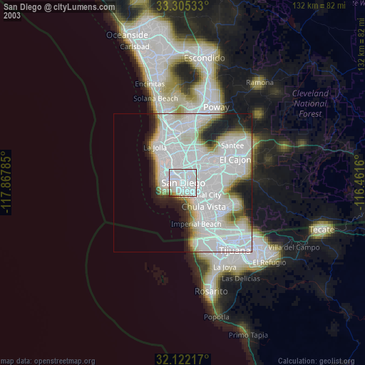
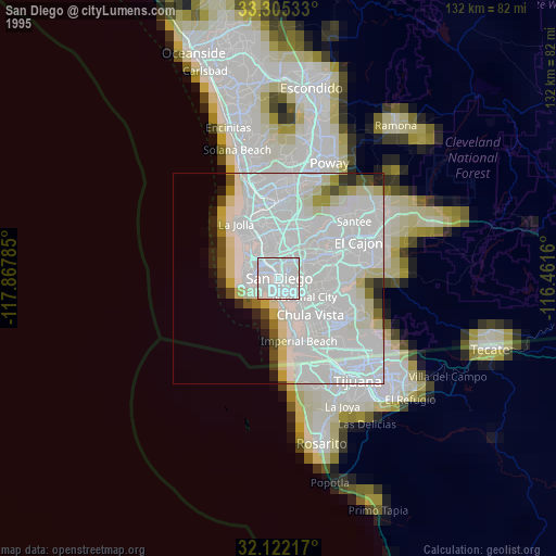
» NASA, Earths city lights 1995
» NASA city lights 2003
» Earth at Night: Flat Maps 2012, 2016
Src.2: Reid Wiseman @astro_reid 2014