La Mesa night lights from space
Night Light of La Mesa (California) from space (United States) Src. Average luminocity for 10x10km area is 78.6923% and for 50x50km: 43.6935%.
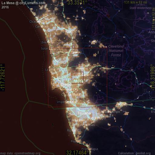
Analysis of La Mesa night lights 2016
Square area 10x10 km:
 13.81%
90-99
16.26%80-89
12.41%70-79
21.33%60-69
30.07%50-59
6.12%40-49
0%30-39
0%20-29
0%10-19
0%0-9
0%Square area 50x50 km:
7.35%90-99
7.86%80-89
4.21%70-79
6.84%60-69
12.55%50-59
9.1%40-49
5.27%30-39
3.38%20-29
6.11%10-19
9.77%0-9
27.56%Clear (daylight) street map image can be seen on geolist.org.
Map coordinates:
33° 21' 25.6" North, 117° 43' 34.4" West
32° 46' 4.2" North, 117° 1' 23.1" West
32° 10' 28.7" North, 116° 19' 11.9" West
Some cities around La Mesa sort by population:
• El Cajon
6.4 km =4 mi,  62°
62°
• Santee
9.1 km =5.7 mi,  30°
30°
• La Presa
7.1 km =4.4 mi,  160°
160°
• Spring Valley
3.4 km =2.1 mi,  138°
138°
• Lemon Grove
2.9 km =1.8 mi,  195°
195°
• Rancho San Diego
8.5 km =5.3 mi,  105°
105°
• Casa de Oro-Mount Helix
5.1 km =3.2 mi,  94°
94°
• Bostonia
9.2 km =5.7 mi, 61°
5363990 (p: 60,089)
Sources (retrieved 2019-11-25):
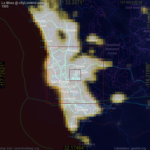
» NASA, Earths city lights 1995
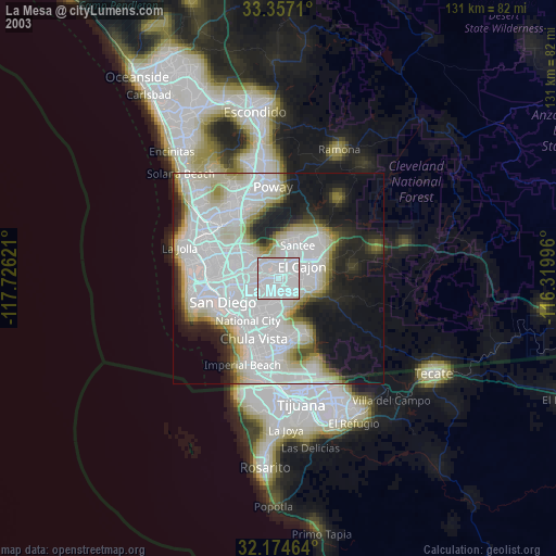
» NASA city lights 2003
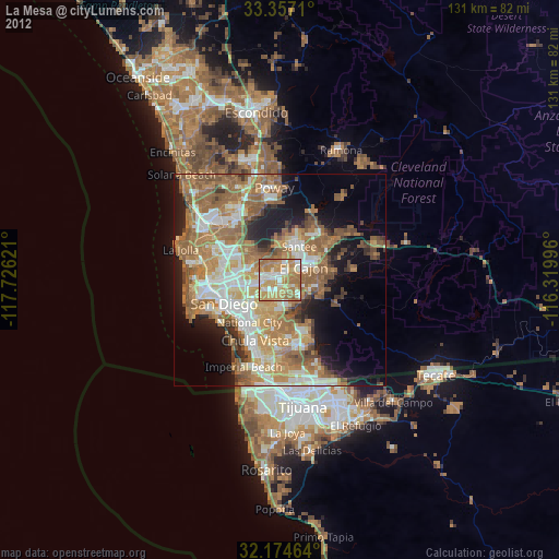
» Earth at Night: Flat Maps 2012, 2016