Bonita night lights from space
Night Light of Bonita (California) from space (United States) Src. Average luminocity for 10x10km area is 72.6224% and for 50x50km: 48.2243%.
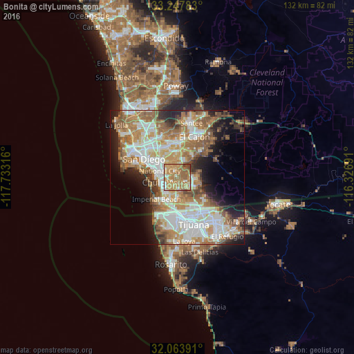
Analysis of Bonita night lights 2016
Square area 10x10 km:
 6.29%
6.29%90-99
8.57%80-89
9.27%70-79
31.47%60-69
30.07%50-59
9.62%40-49
3.85%30-39
0.87%20-29
0%10-19
0%0-9
0%Square area 50x50 km:
10.68%90-99
10.87%80-89
4.96%70-79
7.36%60-69
11.12%50-59
7.18%40-49
4.62%30-39
3.37%20-29
5.52%10-19
8.54%0-9
25.8%Clear (daylight) street map image can be seen on geolist.org.
Map coordinates:
33° 14' 52.2" North, 117° 43' 59.4" West
32° 39' 28.2" North, 117° 1' 48.1" West
32° 3' 50.1" North, 116° 19' 36.9" West
Some cities around Bonita sort by population:
• Chula Vista
5.4 km =3.4 mi,  248°
248°
• National City
6.9 km =4.3 mi,  289°
289°
• La Mesa
12.2 km =7.6 mi,  3°
3°
• La Presa
6.4 km =4 mi,  28°
28°
• Spring Valley
10.1 km =6.3 mi,  16°
16°
• Imperial Beach
11.3 km =7 mi,  223°
223°
• Lemon Grove
9.4 km =5.8 mi,  359°
359°
• Casa de Oro-Mount Helix
13.1 km =8.1 mi, 25°
5329954 (p: 12,538)
Sources (retrieved 2019-11-25):
» Earth at Night: Flat Maps 2012, 2016