National City night lights from space
Night Light of National City (California) from space (United States) Src. Average luminocity for 10x10km area is 82.0559% and for 50x50km: 46.0838%.
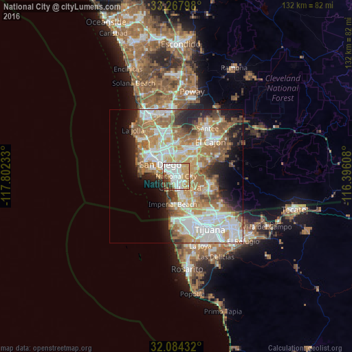
Analysis of National City night lights 2016
Square area 10x10 km:
 25.35%
90-99
26.4%80-89
6.12%70-79
19.93%60-69
7.34%50-59
3.85%40-49
4.02%30-39
6.29%20-29
0.7%10-19
0%0-9
0%Square area 50x50 km:
10.98%90-99
10.58%80-89
4.59%70-79
6.89%60-69
10.31%50-59
6.39%40-49
4.21%30-39
2.73%20-29
5.34%10-19
8.1%0-9
29.87%Clear (daylight) street map image can be seen on geolist.org.
Map coordinates:
33° 16' 4.7" North, 117° 48' 8.4" West
32° 40' 41.2" North, 117° 5' 57.1" West
32° 5' 3.6" North, 116° 23' 45.9" West
Some cities around National City sort by population:
• San Diego
7.4 km =4.6 mi,  304°
304°
• Chula Vista
4.5 km =2.8 mi,  161°
161°
• La Presa
10.1 km =6.3 mi,  70°
70°
• Spring Valley
12 km =7.5 mi,  51°
51°
• Imperial Beach
10.6 km =6.6 mi,  187°
187°
• Lemon Grove
9.6 km =6 mi,  41°
41°
• Coronado
7.9 km =4.9 mi,  276°
276°
• Bonita
6.9 km =4.3 mi,  109°
109°
5376200 (p: 61,060)
Sources (retrieved 2019-11-25):
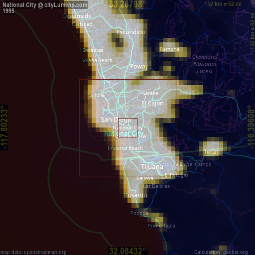
» NASA, Earths city lights 1995
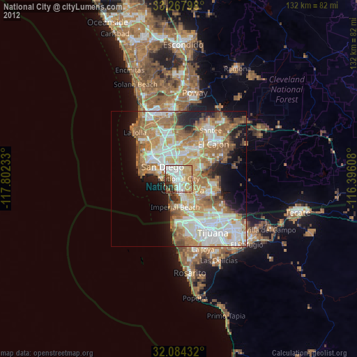
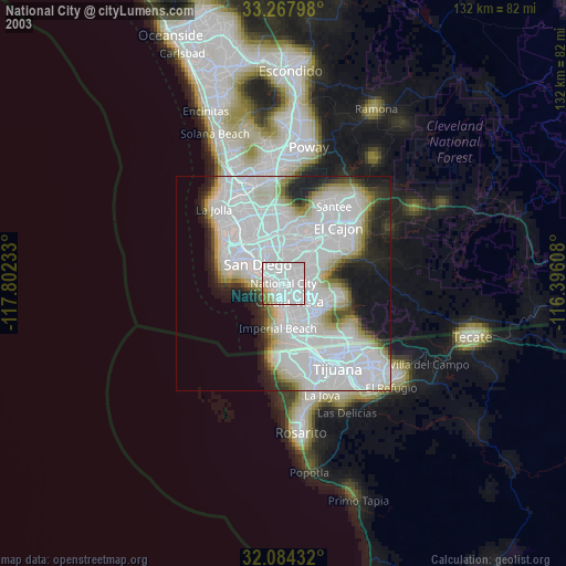
» NASA city lights 2003
» Earth at Night: Flat Maps 2012, 2016