Saint Simons Island night lights from space
Night Light of Saint Simons Island (Georgia) from space (United States) Src. Average luminocity for 10x10km area is 22.3187% and for 50x50km: 8.8135%.
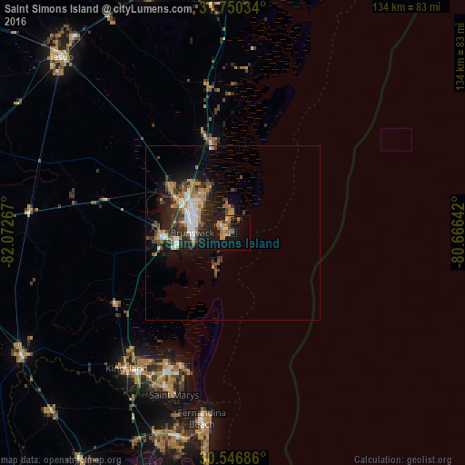
Analysis of Saint Simons Island night lights 2016
Square area 10x10 km:
 0.37%
0.37%90-99
2.2%80-89
1.65%70-79
6.59%60-69
8.06%50-59
1.47%40-49
1.83%30-39
3.3%20-29
2.56%10-19
21.98%0-9
50%Square area 50x50 km:
1.14%90-99
1.19%80-89
0.43%70-79
1.61%60-69
1.61%50-59
0.84%40-49
1.5%30-39
1.82%20-29
2.7%10-19
6.33%0-9
80.84%Clear (daylight) street map image can be seen on geolist.org.
Map coordinates:
31° 45' 1.2" North, 82° 4' 21.6" West
31° 9' 1.8" North, 81° 22' 10.3" West
30° 32' 48.7" North, 80° 39' 59.1" West
Some cities around Saint Simons Island sort by population:
• St. Marys
49.7 km =30.9 mi,  199°
199°
• Kingsland
49.5 km =30.8 mi,  218°
218°
• Brunswick
11.6 km =7.2 mi,  269°
269°
• Fernandina Beach
54.2 km =33.7 mi,  189°
189°
• Yulee
61.9 km =38.5 mi, 201°
• Country Club Estates
11.4 km =7.1 mi,  307°
307°
• Dock Junction
15.2 km =9.4 mi,  292°
292°
• Folkston
70.7 km =43.9 mi,  239°
239°
4220866 (p: 13,000)
Sources (retrieved 2019-11-25):
» Earth at Night: Flat Maps 2012, 2016