Saint Augustine Shores night lights from space
Night Light of Saint Augustine Shores (Florida) from space (United States) Src. Average luminocity for 10x10km area is 47.1766% and for 50x50km: 10.662%.
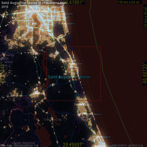
Analysis of Saint Augustine Shores night lights 2016
Square area 10x10 km:
 3.77%
3.77%90-99
3.37%80-89
2.38%70-79
8.13%60-69
23.61%50-59
13.29%40-49
4.37%30-39
4.96%20-29
11.9%10-19
23.02%0-9
1.19%Square area 50x50 km:
0.66%90-99
0.79%80-89
0.51%70-79
1.53%60-69
4.04%50-59
1.7%40-49
1.27%30-39
1.88%20-29
2.75%10-19
11.01%0-9
73.85%Clear (daylight) street map image can be seen on geolist.org.
Map coordinates:
30° 25' 8.4" North, 82° 0' 48.5" West
29° 48' 38.9" North, 81° 18' 37.3" West
29° 11' 55.9" North, 80° 36' 26" West
Some cities around Saint Augustine Shores sort by population:
• Palm Coast
27 km =16.8 mi,  158°
158°
• St. Johns
37.8 km =23.5 mi,  322°
322°
• Ponte Vedra Beach
48.2 km =30 mi,  351°
351°
• Fruit Cove
46.2 km =28.7 mi, 316°
• Fleming Island
50.4 km =31.3 mi,  308°
308°
• Palm Valley
41.4 km =25.7 mi, 349°
• Palatka
36.4 km =22.6 mi,  240°
240°
• Green Cove Springs
40.8 km =25.4 mi,  299°
299°
4170908 (p: 7,359)
Sources (retrieved 2019-11-25):
» Earth at Night: Flat Maps 2012, 2016