Palm Valley night lights from space
Night Light of Palm Valley (Florida) from space (United States) Src. Average luminocity for 10x10km area is 36.4336% and for 50x50km: 31.7422%.
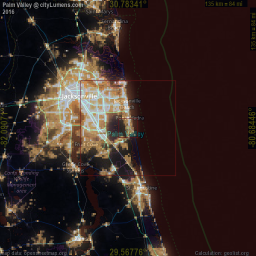
Analysis of Palm Valley night lights 2016
Square area 10x10 km:
 1.22%
1.22%90-99
1.75%80-89
2.8%70-79
5.77%60-69
17.13%50-59
4.37%40-49
5.42%30-39
3.5%20-29
21.5%10-19
30.94%0-9
5.59%Square area 50x50 km:
6.13%90-99
6.11%80-89
3.76%70-79
6.61%60-69
7.52%50-59
2.72%40-49
2.73%30-39
2.22%20-29
5.21%10-19
11.61%0-9
45.37%Clear (daylight) street map image can be seen on geolist.org.
Map coordinates:
30° 47' 0.3" North, 82° 5' 26.6" West
30° 10' 38.9" North, 81° 23' 15.3" West
29° 34' 3.9" North, 80° 41' 4.1" West
Some cities around Palm Valley sort by population:
• Jacksonville
31 km =19.3 mi,  303°
303°
• St. Johns
18.7 km =11.6 mi,  235°
235°
• Ponte Vedra Beach
6.9 km =4.3 mi,  1°
1°
• Fruit Cove
25.5 km =15.8 mi,  253°
253°
• Jacksonville Beach
13 km =8.1 mi,  357°
357°
• Atlantic Beach
17.5 km =10.9 mi, 356°
• Orange Park
30.7 km =19.1 mi,  267°
267°
• Neptune Beach
15 km =9.3 mi, 356°
4167601 (p: 20,019)
Sources (retrieved 2019-11-25):
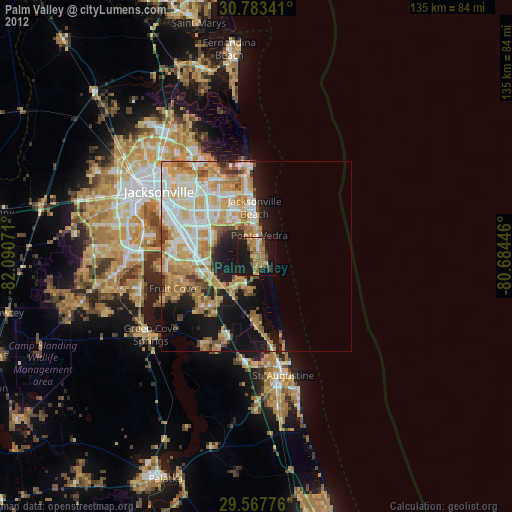
» Earth at Night: Flat Maps 2012, 2016