Palm Coast night lights from space
Night Light of Palm Coast (Florida) from space (United States) Src. Average luminocity for 10x10km area is 51.0139% and for 50x50km: 8.6631%.
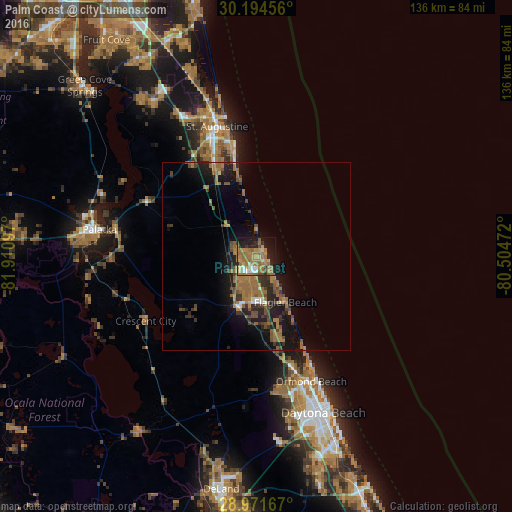
Analysis of Palm Coast night lights 2016
Square area 10x10 km:
 3.17%
3.17%90-99
5.16%80-89
4.37%70-79
11.31%60-69
29.76%50-59
8.13%40-49
2.58%30-39
2.38%20-29
8.73%10-19
20.63%0-9
3.77%Square area 50x50 km:
0.37%90-99
0.4%80-89
0.26%70-79
0.8%60-69
4.24%50-59
1.74%40-49
1.57%30-39
1.55%20-29
2.37%10-19
6.88%0-9
79.84%Clear (daylight) street map image can be seen on geolist.org.
Map coordinates:
30° 11' 40.4" North, 81° 54' 39.5" West
29° 35' 5.9" North, 81° 12' 28.2" West
28° 58' 18" North, 80° 30' 17" West
Some cities around Palm Coast sort by population:
• Daytona Beach
45.3 km =28.1 mi,  156°
156°
• Ormond Beach
36.4 km =22.6 mi, 156°
• Saint Augustine
35.9 km =22.3 mi,  343°
343°
• Holly Hill
41.4 km =25.7 mi, 156°
• Palatka
42.1 km =26.2 mi,  279°
279°
• Ormond-by-the-Sea
29.6 km =18.4 mi,  152°
152°
• Saint Augustine Shores
27 km =16.8 mi, 338°
• Saint Augustine Beach
30 km =18.6 mi,  349°
349°
4167538 (p: 82,893)
Sources (retrieved 2019-11-25):
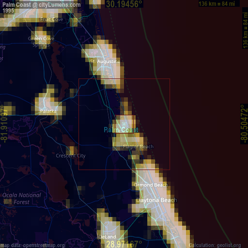
» NASA, Earths city lights 1995
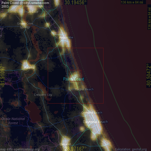
» NASA city lights 2003
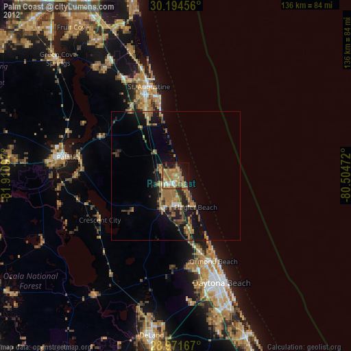
» Earth at Night: Flat Maps 2012, 2016