Rose Hill night lights from space
Night Light of Rose Hill (Virginia) from space (United States) Src. Average luminocity for 10x10km area is 93.2245% and for 50x50km: 71.1611%.
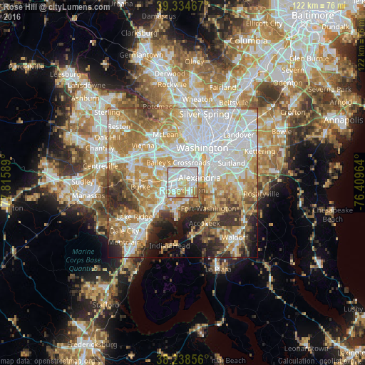
Analysis of Rose Hill night lights 2016
Square area 10x10 km:
 44.73%
90-99
30.1%80-89
11.56%70-79
7.65%60-69
5.95%50-59
0%40-49
0%30-39
0%20-29
0%10-19
0%0-9
0%Square area 50x50 km:
22.56%90-99
15.58%80-89
9.37%70-79
12.19%60-69
10.59%50-59
6.73%40-49
4.38%30-39
5.3%20-29
5.52%10-19
5.27%0-9
2.52%Clear (daylight) street map image can be seen on geolist.org.
Map coordinates:
39° 20' 4.8" North, 77° 48' 57.2" West
38° 47' 19.4" North, 77° 6' 45.9" West
38° 14' 18.8" North, 76° 24' 34.7" West
Some cities around Rose Hill sort by population:
• Alexandria
6 km =3.7 mi,  72°
72°
• Springfield
6.5 km =4 mi,  270°
270°
• Lincolnia
4.2 km =2.6 mi,  321°
321°
• Franconia
3 km =1.9 mi,  255°
255°
• Hybla Valley
5.2 km =3.2 mi,  150°
150°
• Groveton
3.4 km =2.1 mi,  134°
134°
• Huntington
3.7 km =2.3 mi,  83°
83°
• Belle Haven
4.3 km =2.7 mi,  94°
94°
4782864 (p: 20,226)
Sources (retrieved 2019-11-25):
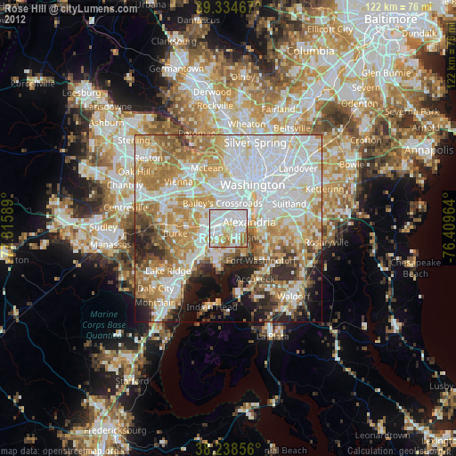
» Earth at Night: Flat Maps 2012, 2016