Roanoke night lights from space
Night Light of Roanoke (Alabama) from space (United States) Src. Average luminocity for 10x10km area is 20.8187% and for 50x50km: 2.4208%.
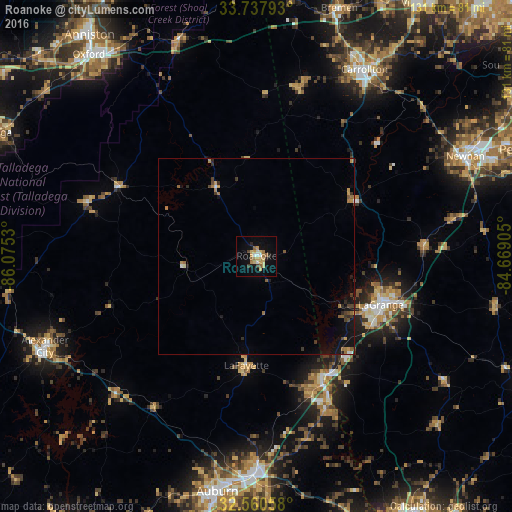
Analysis of Roanoke night lights 2016
Square area 10x10 km:
 1.47%
1.47%90-99
2.2%80-89
4.03%70-79
5.31%60-69
3.66%50-59
2.38%40-49
0.73%30-39
1.47%20-29
2.2%10-19
13.55%0-9
63%Square area 50x50 km:
0.12%90-99
0.16%80-89
0.25%70-79
0.47%60-69
0.5%50-59
0.3%40-49
0.27%30-39
0.49%20-29
0.37%10-19
1.95%0-9
95.12%Clear (daylight) street map image can be seen on geolist.org.
Map coordinates:
33° 44' 16.5" North, 86° 4' 31.1" West
33° 9' 4.4" North, 85° 22' 19.8" West
32° 33' 38.1" North, 84° 40' 8.6" West
Some cities around Roanoke sort by population:
• Auburn
61 km =37.9 mi,  189°
189°
• Newnan
59 km =36.7 mi,  64°
64°
• LaGrange
34.1 km =21.2 mi,  111°
111°
• Opelika
56.2 km =34.9 mi,  180°
180°
• Carrollton
55 km =34.2 mi,  29°
29°
• Alexander City
58.9 km =36.6 mi,  246°
246°
• Valley
41.1 km =25.5 mi,  154°
154°
• Lanett
35.7 km =22.2 mi, 151°
4086285 (p: 6,005)
Sources (retrieved 2019-11-25):
» Earth at Night: Flat Maps 2012, 2016