Newnan night lights from space
Night Light of Newnan (Georgia) from space (United States) Src. Average luminocity for 10x10km area is 66.4301% and for 50x50km: 22.0138%.
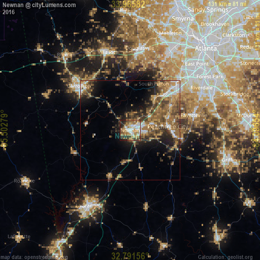
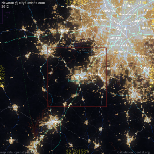
Analysis of Newnan night lights 2016
Square area 10x10 km:
 11.19%
90-99
13.81%80-89
10.84%70-79
14.51%60-69
13.11%50-59
7.69%40-49
9.79%30-39
6.99%20-29
9.09%10-19
2.97%0-9
0%Square area 50x50 km:
2.11%90-99
2.44%80-89
2.57%70-79
4.1%60-69
4.81%50-59
4.84%40-49
4.46%30-39
4.42%20-29
4.49%10-19
6.82%0-9
58.93%Clear (daylight) street map image can be seen on geolist.org.
Map coordinates:
33° 57' 57" North, 85° 30' 10" West
33° 22' 50.4" North, 84° 47' 58.8" West
32° 47' 29.6" North, 84° 5' 47.5" West
Some cities around Newnan sort by population:
• Peachtree City
19 km =11.8 mi,  84°
84°
• Douglasville
41.5 km =25.8 mi,  6°
6°
• Carrollton
33.9 km =21.1 mi,  310°
310°
• Union City
33.1 km =20.6 mi,  46°
46°
• Fayetteville
32.9 km =20.4 mi, 76°
• Villa Rica
40.6 km =25.2 mi,  344°
344°
• Fairburn
29 km =18 mi,  44°
44°
• Tyrone
21.3 km =13.2 mi,  61°
61°
4212684 (p: 37,291)
Sources (retrieved 2019-11-25):
» Earth at Night: Flat Maps 2012, 2016