Riverdale night lights from space
Night Light of Riverdale (Illinois) from space (United States) Src. Average luminocity for 10x10km area is 98.8231% and for 50x50km: 72.2227%.
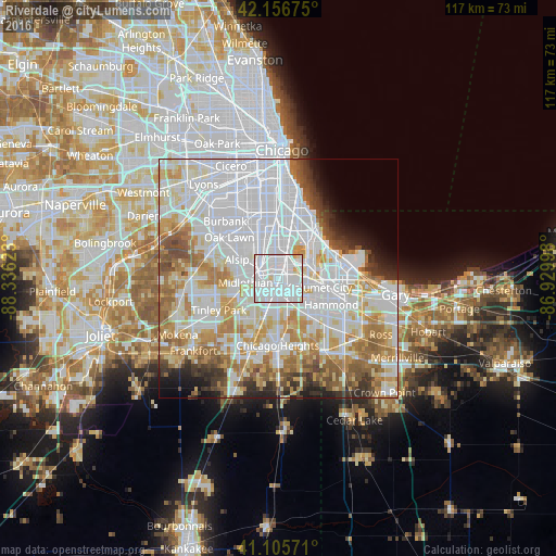
Analysis of Riverdale night lights 2016
Square area 10x10 km:
 64.29%
90-99
32.95%80-89
2.27%70-79
0.49%60-69
0%50-59
0%40-49
0%30-39
0%20-29
0%10-19
0%0-9
0%Square area 50x50 km:
31.24%90-99
16.78%80-89
7.95%70-79
7.95%60-69
8.1%50-59
5.14%40-49
3.24%30-39
3.33%20-29
3.04%10-19
3.16%0-9
10.06%Clear (daylight) street map image can be seen on geolist.org.
Map coordinates:
42° 9' 24.3" North, 88° 20' 10.4" West
41° 38' 0.1" North, 87° 37' 59.2" West
41° 6' 20.6" North, 86° 55' 47.9" West
Some cities around Riverdale sort by population:
• Harvey
2.8 km =1.7 mi,  203°
203°
• Blue Island
4.7 km =2.9 mi,  304°
304°
• Dolton
2.2 km =1.4 mi,  73°
73°
• South Holland
4.2 km =2.6 mi,  149°
149°
• Markham
6.8 km =4.2 mi,  229°
229°
• Calumet Park
4 km =2.5 mi,  325°
325°
• Posen
4 km =2.5 mi,  267°
267°
• Robbins
6 km =3.7 mi,  281°
281°
4907683 (p: 13,536)
Sources (retrieved 2019-11-25):
» Earth at Night: Flat Maps 2012, 2016