Redwood Falls night lights from space
Night Light of Redwood Falls (Minnesota) from space (United States) Src. Average luminocity for 10x10km area is 12.5% and for 50x50km: 0.8466%.
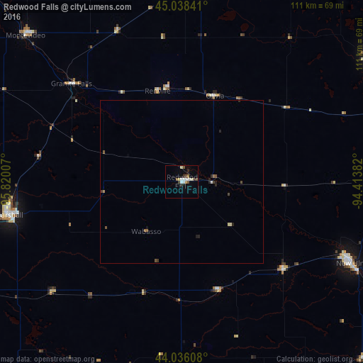
Analysis of Redwood Falls night lights 2016
Square area 10x10 km:
 2.22%
2.22%90-99
3.33%80-89
0.79%70-79
0.63%60-69
0.63%50-59
1.9%40-49
1.43%30-39
1.9%20-29
1.43%10-19
1.27%0-9
84.44%Square area 50x50 km:
0.1%90-99
0.13%80-89
0.08%70-79
0.02%60-69
0.1%50-59
0.19%40-49
0.11%30-39
0.16%20-29
0.25%10-19
0.1%0-9
98.76%Clear (daylight) street map image can be seen on geolist.org.
Map coordinates:
45° 2' 18.3" North, 95° 49' 12.3" West
44° 32' 21.8" North, 95° 7' 1" West
44° 2' 9.9" North, 94° 24' 49.8" West
Some cities around Redwood Falls sort by population:
• Willmar
65 km =40.4 mi,  5°
5°
• Hutchinson
70.6 km =43.9 mi,  56°
56°
• Marshall
54.2 km =33.7 mi,  259°
259°
• New Ulm
57.9 km =36 mi,  115°
115°
• Saint Peter
95.1 km =59.1 mi,  104°
104°
• Litchfield
80.2 km =49.8 mi,  35°
35°
• Glencoe
80.5 km =50 mi,  71°
71°
• Montevideo
65.7 km =40.8 mi,  313°
313°
5042832 (p: 5,061)
Sources (retrieved 2019-11-25):
» Earth at Night: Flat Maps 2012, 2016