Saint Peter night lights from space
Night Light of Saint Peter (Minnesota) from space (United States) Src. Average luminocity for 10x10km area is 18.9238% and for 50x50km: 5.3499%.
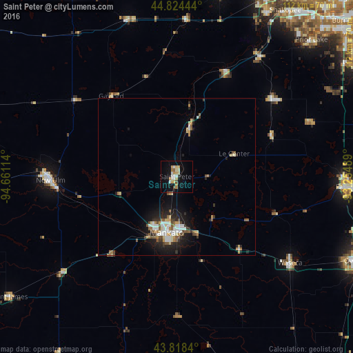
Analysis of Saint Peter night lights 2016
Square area 10x10 km:
 2.22%
2.22%90-99
3.65%80-89
4.13%70-79
2.7%60-69
1.9%50-59
0.95%40-49
0.95%30-39
0%20-29
1.43%10-19
16.35%0-9
65.71%Square area 50x50 km:
0.85%90-99
0.87%80-89
0.71%70-79
0.56%60-69
0.62%50-59
0.7%40-49
0.52%30-39
0.56%20-29
1.46%10-19
3.6%0-9
89.54%Clear (daylight) street map image can be seen on geolist.org.
Map coordinates:
44° 49' 28" North, 94° 39' 40.1" West
44° 19' 24.9" North, 93° 57' 28.8" West
43° 49' 6.2" North, 93° 15' 17.6" West
Some cities around Saint Peter sort by population:
• Mankato
18.7 km =11.6 mi,  192°
192°
• North Mankato
17.8 km =11.1 mi,  199°
199°
• New Ulm
40 km =24.9 mi,  268°
268°
• Waseca
45.1 km =28 mi,  127°
127°
• New Prague
38.9 km =24.2 mi,  51°
51°
• Belle Plaine
36.5 km =22.7 mi,  24°
24°
• Jordan
46.3 km =28.8 mi,  34°
34°
• Glencoe
51.9 km =32.2 mi,  342°
342°
5045517 (p: 11,196)
Sources (retrieved 2019-11-25):
» Earth at Night: Flat Maps 2012, 2016