San Bernardino night lights from space
Night Light of San Bernardino (California) from space (United States) Src. Average luminocity for 10x10km area is 95.3297% and for 50x50km: 47.1201%.
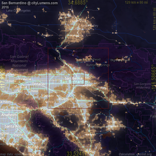
Analysis of San Bernardino night lights 2016
Square area 10x10 km:
 50.73%
90-99
30.04%80-89
11.9%70-79
6.41%60-69
0.92%50-59
0%40-49
0%30-39
0%20-29
0%10-19
0%0-9
0%Square area 50x50 km:
10.93%90-99
10.59%80-89
5.61%70-79
7.43%60-69
11.29%50-59
5.08%40-49
3.77%30-39
2.8%20-29
4.87%10-19
7.63%0-9
30%Clear (daylight) street map image can be seen on geolist.org.
Map coordinates:
34° 41' 18.6" North, 117° 59' 34.4" West
34° 6' 30" North, 117° 17' 23.2" West
33° 31' 27" North, 116° 35' 11.9" West
Some cities around San Bernardino sort by population:
• Rialto
7.4 km =4.6 mi,  268°
268°
• Redlands
11.5 km =7.1 mi,  120°
120°
• Highland
7.8 km =4.8 mi,  73°
73°
• Colton
4.4 km =2.7 mi,  209°
209°
• Loma Linda
7.2 km =4.5 mi,  158°
158°
• Bloomington
10.6 km =6.6 mi,  246°
246°
• Grand Terrace
8.6 km =5.3 mi,  194°
194°
• Muscoy
7.1 km =4.4 mi,  315°
315°
5391710 (p: 216,108)
Sources (retrieved 2019-11-25):
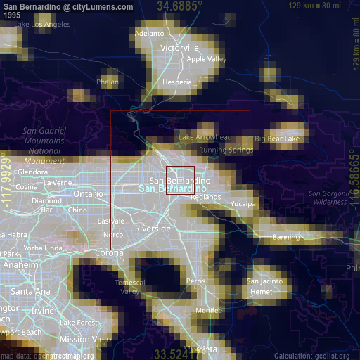
» NASA, Earths city lights 1995
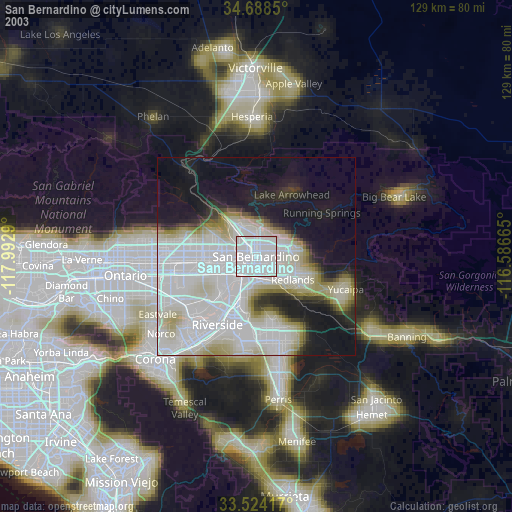
» NASA city lights 2003
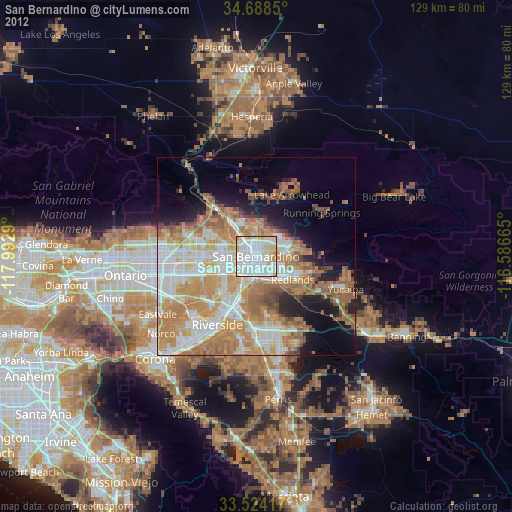
» Earth at Night: Flat Maps 2012, 2016