Colton night lights from space
Night Light of Colton (California) from space (United States) Src. Average luminocity for 10x10km area is 91.7955% and for 50x50km: 52.6996%.
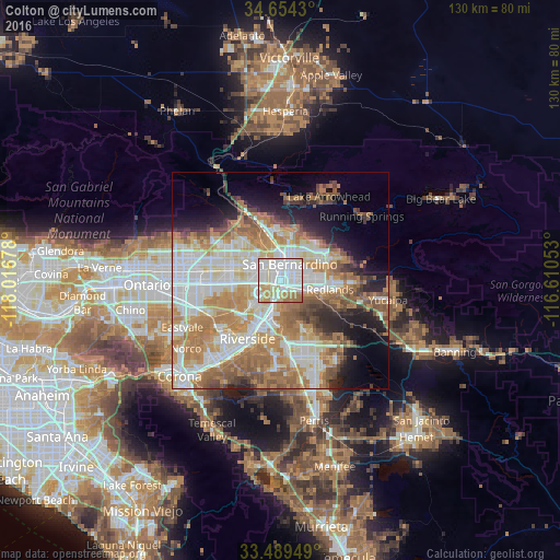
Analysis of Colton night lights 2016
Square area 10x10 km:
 44.41%
90-99
26.22%80-89
11.01%70-79
8.92%60-69
9.09%50-59
0.35%40-49
0%30-39
0%20-29
0%10-19
0%0-9
0%Square area 50x50 km:
12.54%90-99
11.96%80-89
6.05%70-79
8.25%60-69
12.6%50-59
6.12%40-49
4.16%30-39
2.87%20-29
5.24%10-19
7.76%0-9
22.46%Clear (daylight) street map image can be seen on geolist.org.
Map coordinates:
34° 39' 15.5" North, 118° 1' 0.4" West
34° 4' 26" North, 117° 18' 49.1" West
33° 29' 22.2" North, 116° 36' 37.9" West
Some cities around Colton sort by population:
• San Bernardino
4.4 km =2.7 mi,  29°
29°
• Fontana
11.4 km =7.1 mi,  280°
280°
• Rialto
6.3 km =3.9 mi,  304°
304°
• Highland
11.4 km =7.1 mi,  57°
57°
• Loma Linda
5.6 km =3.5 mi,  120°
120°
• Bloomington
7.6 km =4.7 mi,  266°
266°
• Grand Terrace
4.4 km =2.7 mi,  180°
180°
• Muscoy
9.4 km =5.8 mi,  342°
342°
5338783 (p: 54,621)
Sources (retrieved 2019-11-25):
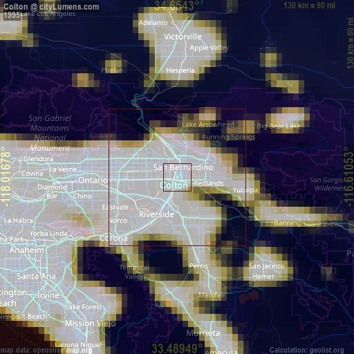
» NASA, Earths city lights 1995
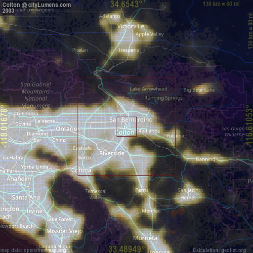
» NASA city lights 2003
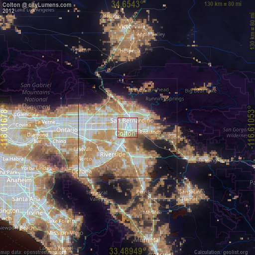
» Earth at Night: Flat Maps 2012, 2016