Reading night lights from space
Night Light of Reading (Pennsylvania) from space (United States) Src. Average luminocity for 10x10km area is 79.5952% and for 50x50km: 21.6443%.
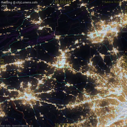
Analysis of Reading night lights 2016
Square area 10x10 km:
 23.3%
23.3%90-99
23.47%80-89
13.44%70-79
9.01%60-69
8.67%50-59
9.01%40-49
5.44%30-39
5.1%20-29
2.55%10-19
0%0-9
0%Square area 50x50 km:
2.32%90-99
2.65%80-89
3.4%70-79
2.9%60-69
2.46%50-59
2.88%40-49
3.29%30-39
3.55%20-29
6.77%10-19
19.49%0-9
50.28%Clear (daylight) street map image can be seen on geolist.org.
Map coordinates:
40° 52' 10.2" North, 76° 37' 48" West
40° 20' 8.3" North, 75° 55' 36.7" West
39° 47' 51.2" North, 75° 13' 25.5" West
Some cities around Reading sort by population:
• Pottstown
25.6 km =15.9 mi,  113°
113°
• Ephrata
27.5 km =17.1 mi,  230°
230°
• Wyomissing
3.3 km =2.1 mi,  258°
258°
• Blandon
12.2 km =7.6 mi,  16°
16°
• New Holland
29.3 km =18.2 mi,  207°
207°
• Shillington
4.5 km =2.8 mi, 226°
• Birdsboro
13.1 km =8.1 mi,  127°
127°
• Kutztown
23.8 km =14.8 mi,  32°
32°
5207728 (p: 87,879)
Sources (retrieved 2019-11-25):
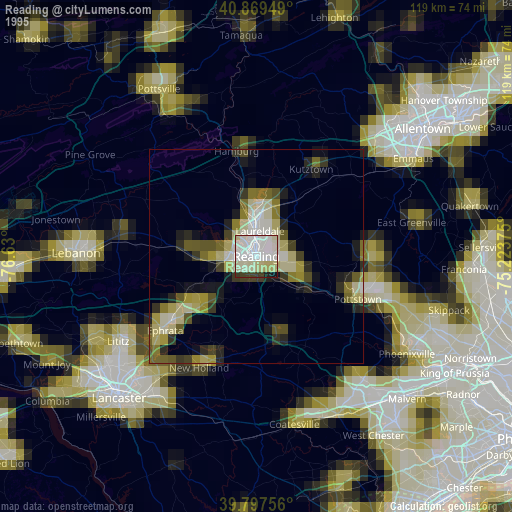
» NASA, Earths city lights 1995
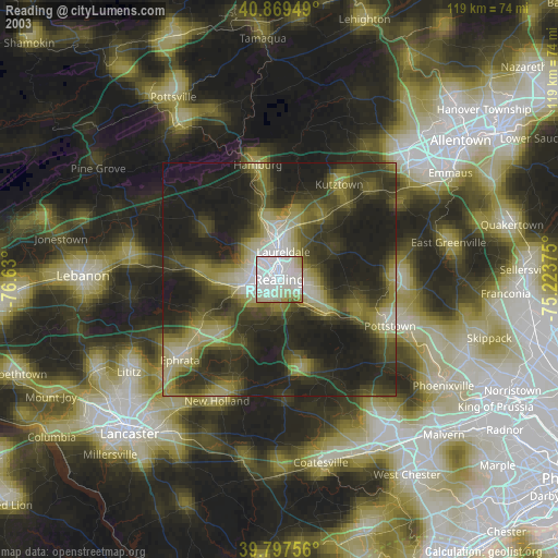
» NASA city lights 2003
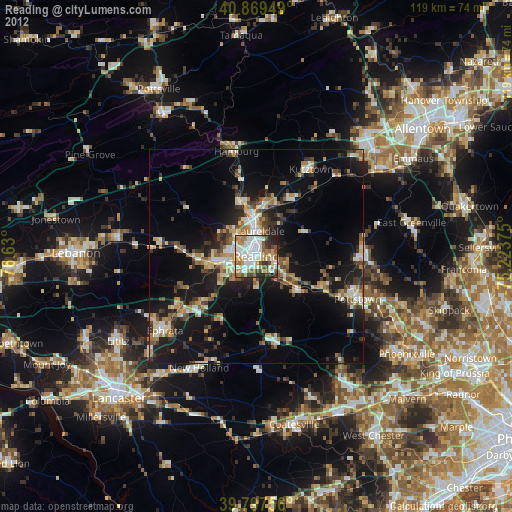
» Earth at Night: Flat Maps 2012, 2016