Rainsville night lights from space
Night Light of Rainsville (Alabama) from space (United States) Src. Average luminocity for 10x10km area is 20.7622% and for 50x50km: 7.7633%.
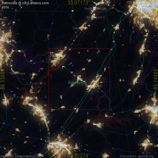
Analysis of Rainsville night lights 2016
Square area 10x10 km:
 1.05%
1.05%90-99
0.87%80-89
3.5%70-79
3.85%60-69
3.32%50-59
3.5%40-49
3.5%30-39
3.15%20-29
1.4%10-19
17.83%0-9
58.04%Square area 50x50 km:
0.43%90-99
0.52%80-89
1.52%70-79
1.25%60-69
1.19%50-59
1.1%40-49
1.07%30-39
1.47%20-29
1.82%10-19
6.57%0-9
83.07%Clear (daylight) street map image can be seen on geolist.org.
Map coordinates:
35° 4' 18.2" North, 86° 33' 3.2" West
34° 29' 39.3" North, 85° 50' 51.9" West
33° 54' 45.9" North, 85° 8' 40.7" West
Some cities around Rainsville sort by population:
• Gadsden
55.3 km =34.4 mi,  195°
195°
• Albertville
41.6 km =25.8 mi,  232°
232°
• Scottsboro
26.1 km =16.2 mi,  319°
319°
• Fort Payne
13 km =8.1 mi,  115°
115°
• Boaz
43.8 km =27.2 mi,  221°
221°
• Guntersville
43.7 km =27.2 mi,  249°
249°
• LaFayette
56.8 km =35.3 mi,  65°
65°
• Attalla
57 km =35.4 mi, 202°
4085373 (p: 5,031)
Sources (retrieved 2019-11-25):
» Earth at Night: Flat Maps 2012, 2016