Racine night lights from space
Night Light of Racine (Wisconsin) from space (United States) Src. Average luminocity for 10x10km area is 52.7879% and for 50x50km: 21.9129%.
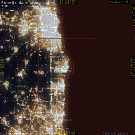
Analysis of Racine night lights 2016
Square area 10x10 km:
 17.27%
90-99
17.58%80-89
2.12%70-79
4.7%60-69
6.52%50-59
4.24%40-49
1.21%30-39
1.97%20-29
10.91%10-19
14.09%0-9
19.39%Square area 50x50 km:
4.08%90-99
3.95%80-89
2.28%70-79
2.6%60-69
3.47%50-59
3.82%40-49
2.95%30-39
3.12%20-29
6.71%10-19
8.3%0-9
58.74%Clear (daylight) street map image can be seen on geolist.org.
Map coordinates:
43° 14' 25.8" North, 88° 29' 9.5" West
42° 43' 34.1" North, 87° 46' 58.3" West
42° 12' 26.9" North, 87° 4' 47" West
Some cities around Racine sort by population:
• Kenosha
16 km =9.9 mi,  191°
191°
• Oak Creek
18.9 km =11.7 mi,  339°
339°
• Mount Pleasant
6.8 km =4.2 mi,  241°
241°
• Caledonia
14.7 km =9.1 mi,  308°
308°
• South Milwaukee
21.5 km =13.4 mi, 342°
• Pleasant Prairie
22.8 km =14.2 mi,  212°
212°
• Somers
14.1 km =8.8 mi,  227°
227°
• Sturtevant
9.6 km =6 mi,  251°
251°
5268249 (p: 77,742)
Sources (retrieved 2019-11-25):
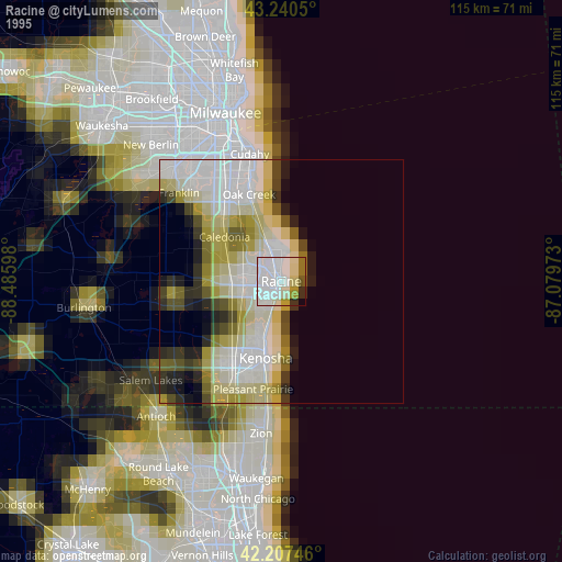
» NASA, Earths city lights 1995
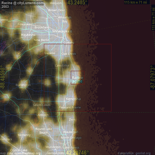
» NASA city lights 2003
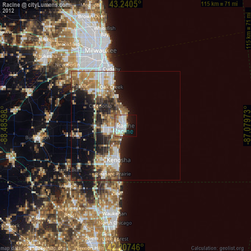
» Earth at Night: Flat Maps 2012, 2016