Caledonia night lights from space
Night Light of Caledonia (Wisconsin) from space (United States) Src. Average luminocity for 10x10km area is 34.2773% and for 50x50km: 29.7931%.
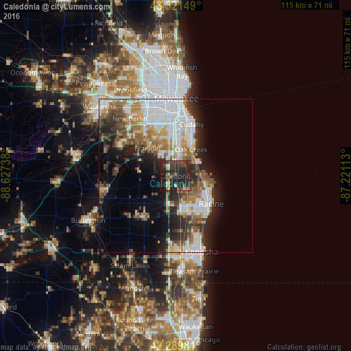
Analysis of Caledonia night lights 2016
Square area 10x10 km:
 1.82%
1.82%90-99
1.36%80-89
4.85%70-79
2.27%60-69
3.18%50-59
5.76%40-49
8.94%30-39
13.33%20-29
34.85%10-19
22.73%0-9
0.91%Square area 50x50 km:
8.23%90-99
5.06%80-89
2.55%70-79
3.09%60-69
4.25%50-59
4.46%40-49
3.79%30-39
3.86%20-29
7.55%10-19
8.8%0-9
48.36%Clear (daylight) street map image can be seen on geolist.org.
Map coordinates:
43° 19' 17.4" North, 88° 37' 38.6" West
42° 48' 28.1" North, 87° 55' 27.3" West
42° 17' 23.3" North, 87° 13' 16.1" West
Some cities around Caledonia sort by population:
• Racine
14.7 km =9.1 mi,  128°
128°
• Franklin
12.9 km =8 mi,  313°
313°
• Oak Creek
10 km =6.2 mi,  29°
29°
• Mount Pleasant
13.5 km =8.4 mi,  155°
155°
• South Milwaukee
12.5 km =7.8 mi,  24°
24°
• Greendale
15.9 km =9.9 mi,  338°
338°
• Hales Corners
17.6 km =10.9 mi,  324°
324°
• Sturtevant
12.4 km =7.7 mi,  168°
168°
5247415 (p: 24,684)
Sources (retrieved 2019-11-25):
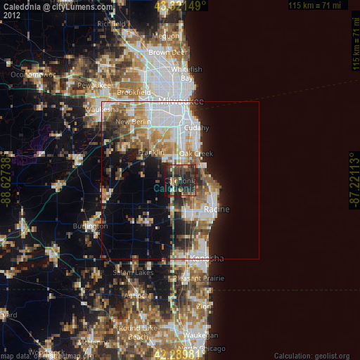
» Earth at Night: Flat Maps 2012, 2016