Provo night lights from space
Night Light of Provo (Utah) from space (United States) Src. Average luminocity for 10x10km area is 65.8977% and for 50x50km: 17.0396%.

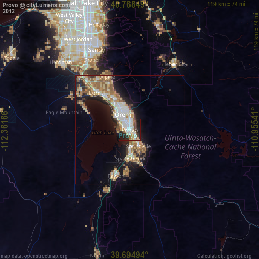
Analysis of Provo night lights 2016
Square area 10x10 km:
 18.99%
90-99
20.94%80-89
6.01%70-79
6.49%60-69
6.33%50-59
2.92%40-49
6.33%30-39
8.6%20-29
16.56%10-19
6.66%0-9
0.16%Square area 50x50 km:
2.65%90-99
2.82%80-89
2.26%70-79
2.55%60-69
2.48%50-59
3.08%40-49
1.95%30-39
2.22%20-29
5.07%10-19
8.24%0-9
66.67%Clear (daylight) street map image can be seen on geolist.org.
Map coordinates:
40° 46' 6.6" North, 112° 21' 42" West
40° 14' 1.8" North, 111° 39' 30.7" West
39° 41' 41.8" North, 110° 57' 19.5" West
Some cities around Provo sort by population:
• Orem
7.7 km =4.8 mi,  336°
336°
• Pleasant Grove
16 km =9.9 mi,  334°
334°
• Spanish Fork
13.2 km =8.2 mi,  178°
178°
• Springville
8.6 km =5.3 mi,  151°
151°
• American Fork
19.7 km =12.2 mi,  323°
323°
• Lindon
13.3 km =8.3 mi, 336°
• Mapleton
13.4 km =8.3 mi, 149°
• Salem
20.1 km =12.5 mi, 183°
5780026 (p: 115,264)
Sources (retrieved 2019-11-25):
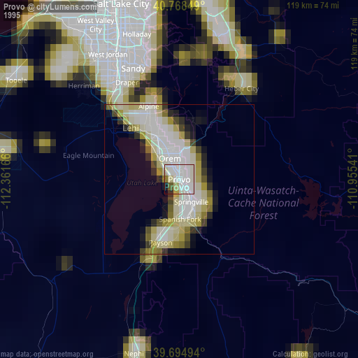
» NASA, Earths city lights 1995
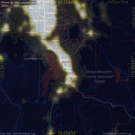
» NASA city lights 2003
» Earth at Night: Flat Maps 2012, 2016