Pleasant Grove night lights from space
Night Light of Pleasant Grove (Utah) from space (United States) Src. Average luminocity for 10x10km area is 62.0918% and for 50x50km: 24.1851%.
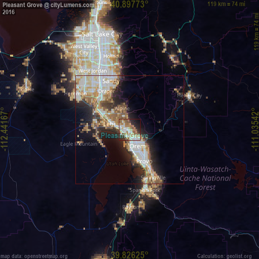
Analysis of Pleasant Grove night lights 2016
Square area 10x10 km:
 14.29%
90-99
11.9%80-89
10.54%70-79
3.91%60-69
12.76%50-59
14.12%40-49
4.08%30-39
4.76%20-29
13.78%10-19
8.16%0-9
1.7%Square area 50x50 km:
4.75%90-99
5.21%80-89
3.36%70-79
3.05%60-69
3.36%50-59
3.67%40-49
2.36%30-39
2.6%20-29
6.06%10-19
7.75%0-9
57.85%Clear (daylight) street map image can be seen on geolist.org.
Map coordinates:
40° 53' 51.8" North, 112° 26' 30" West
40° 21' 50.8" North, 111° 44' 18.7" West
39° 49' 34.5" North, 111° 2' 7.5" West
Some cities around Pleasant Grove sort by population:
• Orem
8.3 km =5.2 mi,  153°
153°
• Lehi
10 km =6.2 mi,  287°
287°
• American Fork
5.1 km =3.2 mi, 286°
• Saratoga Springs
14.2 km =8.8 mi,  263°
263°
• Highland
8.3 km =5.2 mi,  325°
325°
• Lindon
2.8 km =1.7 mi, 146°
• Cedar Hills
5.8 km =3.6 mi,  343°
343°
• Alpine
10.5 km =6.5 mi, 341°
5779816 (p: 38,052)
Sources (retrieved 2019-11-25):
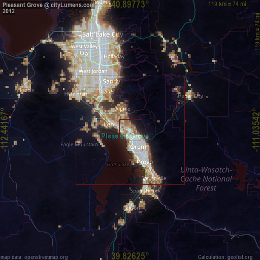
» Earth at Night: Flat Maps 2012, 2016