Providence night lights from space
Night Light of Providence (Rhode Island) from space (United States) Src. Average luminocity for 10x10km area is 96.2652% and for 50x50km: 40.2255%.
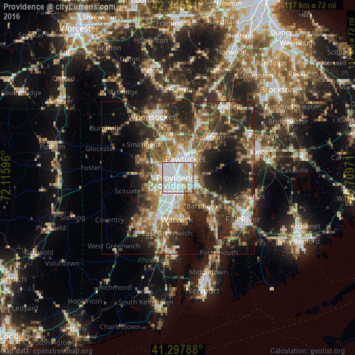
Analysis of Providence night lights 2016
Square area 10x10 km:
 60.91%
90-99
25.3%80-89
6.06%70-79
5.61%60-69
1.21%50-59
0.61%40-49
0.3%30-39
0%20-29
0%10-19
0%0-9
0%Square area 50x50 km:
7.43%90-99
6.72%80-89
4.11%70-79
4.9%60-69
6.61%50-59
7.62%40-49
7.15%30-39
7.03%20-29
11.13%10-19
12.28%0-9
25.03%Clear (daylight) street map image can be seen on geolist.org.
Map coordinates:
42° 20' 44.9" North, 72° 6' 57.5" West
41° 49' 26.4" North, 71° 24' 46.2" West
41° 17' 52.4" North, 70° 42' 35" West
Some cities around Providence sort by population:
• Cranston
5.3 km =3.3 mi,  202°
202°
• Pawtucket
6.6 km =4.1 mi,  22°
22°
• East Providence
3.7 km =2.3 mi,  107°
107°
• North Providence
5.3 km =3.3 mi,  303°
303°
• Johnston
7.8 km =4.8 mi,  268°
268°
• Central Falls
7.6 km =4.7 mi,  12°
12°
• Seekonk
6.5 km =4 mi, 105°
• Valley Falls
9.4 km =5.8 mi, 11°
5224151 (p: 179,207)
Sources (retrieved 2019-11-25):
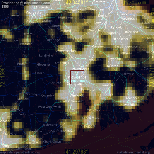
» NASA, Earths city lights 1995
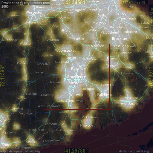
» NASA city lights 2003
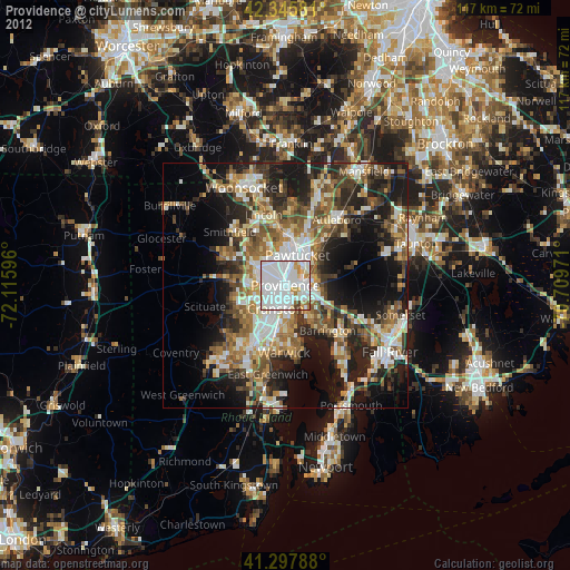
» Earth at Night: Flat Maps 2012, 2016