North Providence night lights from space
Night Light of North Providence (Rhode Island) from space (United States) Src. Average luminocity for 10x10km area is 84.273% and for 50x50km: 36.8235%.
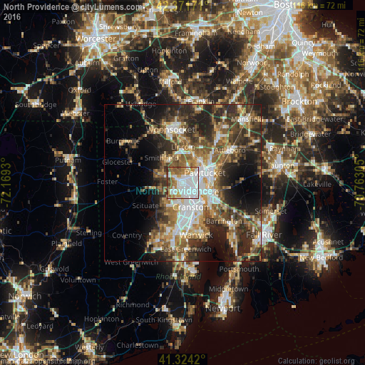
Analysis of North Providence night lights 2016
Square area 10x10 km:
 42.06%
90-99
17.14%80-89
4.76%70-79
9.52%60-69
9.52%50-59
10%40-49
3.17%30-39
3.81%20-29
0%10-19
0%0-9
0%Square area 50x50 km:
6.7%90-99
6.06%80-89
3.71%70-79
4.64%60-69
5.91%50-59
6.95%40-49
6.64%30-39
7.01%20-29
10.72%10-19
9.99%0-9
31.67%Clear (daylight) street map image can be seen on geolist.org.
Map coordinates:
42° 22' 18.2" North, 72° 10' 9.5" West
41° 51' 0.4" North, 71° 27' 58.2" West
41° 19' 27.1" North, 70° 45' 47" West
Some cities around North Providence sort by population:
• Providence
5.3 km =3.3 mi,  123°
123°
• Cranston
8.2 km =5.1 mi,  162°
162°
• Pawtucket
7.6 km =4.7 mi,  65°
65°
• Johnston
4.6 km =2.9 mi,  226°
226°
• Lincoln
8.3 km =5.2 mi,  18°
18°
• Central Falls
7.6 km =4.7 mi,  53°
53°
• Valley Falls
8.9 km =5.5 mi,  44°
44°
• Greenville
7.5 km =4.7 mi,  288°
288°
5223681 (p: 33,835)
Sources (retrieved 2019-11-25):
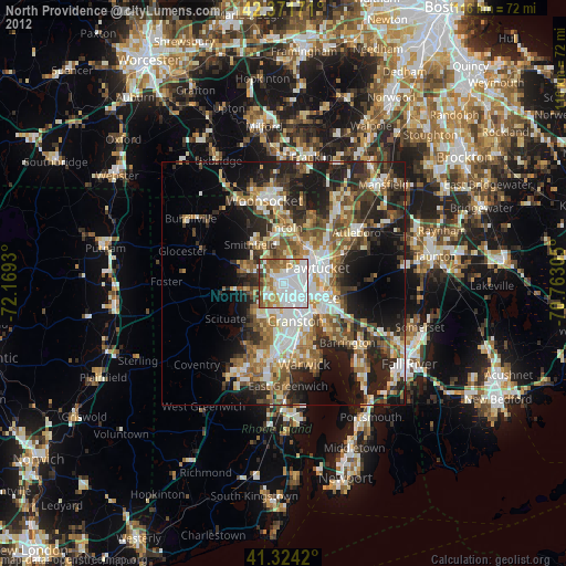
» Earth at Night: Flat Maps 2012, 2016