Pawtucket night lights from space
Night Light of Pawtucket (Rhode Island) from space (United States) Src. Average luminocity for 10x10km area is 85.8905% and for 50x50km: 43.4409%.
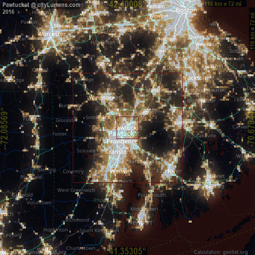

Analysis of Pawtucket night lights 2016
Square area 10x10 km:
 34.29%
90-99
23.33%80-89
9.05%70-79
13.17%60-69
7.3%50-59
10.63%40-49
2.22%30-39
0%20-29
0%10-19
0%0-9
0%Square area 50x50 km:
7.82%90-99
7.24%80-89
4.44%70-79
5.16%60-69
6.63%50-59
8.25%40-49
7.66%30-39
8.67%20-29
14.15%10-19
12.79%0-9
17.19%Clear (daylight) street map image can be seen on geolist.org.
Map coordinates:
42° 24' 0.3" North, 72° 5' 8.5" West
41° 52' 43.4" North, 71° 22' 57.2" West
41° 21' 11" North, 70° 40' 46" West
Some cities around Pawtucket sort by population:
• Providence
6.6 km =4.1 mi,  202°
202°
• East Providence
7.3 km =4.5 mi,  171°
171°
• Cumberland
10.6 km =6.6 mi,  336°
336°
• North Providence
7.6 km =4.7 mi,  245°
245°
• Lincoln
6.4 km =4 mi,  317°
317°
• Central Falls
1.6 km =1 mi,  328°
328°
• Seekonk
8.7 km =5.4 mi,  154°
154°
• Valley Falls
3.2 km =2 mi,  347°
347°
5223869 (p: 71,591)
Sources (retrieved 2019-11-25):
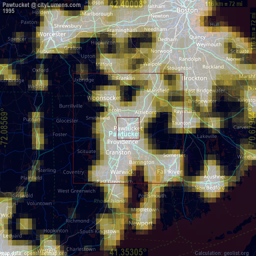
» NASA, Earths city lights 1995
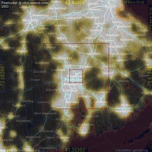
» NASA city lights 2003
» Earth at Night: Flat Maps 2012, 2016