East Providence night lights from space
Night Light of East Providence (Rhode Island) from space (United States) Src. Average luminocity for 10x10km area is 84.2591% and for 50x50km: 42.1228%.
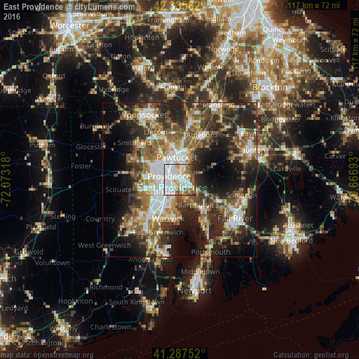
Analysis of East Providence night lights 2016
Square area 10x10 km:
 39.09%
90-99
21.67%80-89
7.12%70-79
6.52%60-69
5.91%50-59
10.61%40-49
5.61%30-39
2.58%20-29
0.91%10-19
0%0-9
0%Square area 50x50 km:
7.69%90-99
7.08%80-89
4.29%70-79
5.08%60-69
6.75%50-59
8.08%40-49
7.34%30-39
7.18%20-29
12.35%10-19
13.95%0-9
20.21%Clear (daylight) street map image can be seen on geolist.org.
Map coordinates:
42° 20' 8.2" North, 72° 4' 23.4" West
41° 48' 49.4" North, 71° 22' 12.2" West
41° 17' 15.1" North, 70° 40' 0.9" West
Some cities around East Providence sort by population:
• Providence
3.7 km =2.3 mi,  287°
287°
• Cranston
6.7 km =4.2 mi,  235°
235°
• Pawtucket
7.3 km =4.5 mi,  351°
351°
• North Providence
8.9 km =5.5 mi,  296°
296°
• Central Falls
8.8 km =5.5 mi, 347°
• Barrington
9.6 km =6 mi,  147°
147°
• Seekonk
2.8 km =1.7 mi,  102°
102°
• Rehoboth
10.4 km =6.5 mi,  73°
73°
5221931 (p: 47,408)
Sources (retrieved 2019-11-25):
» Earth at Night: Flat Maps 2012, 2016