Grandview Heights night lights from space
Night Light of Grandview Heights (Ohio) from space (United States) Src. Average luminocity for 10x10km area is 98.1701% and for 50x50km: 52.4868%.
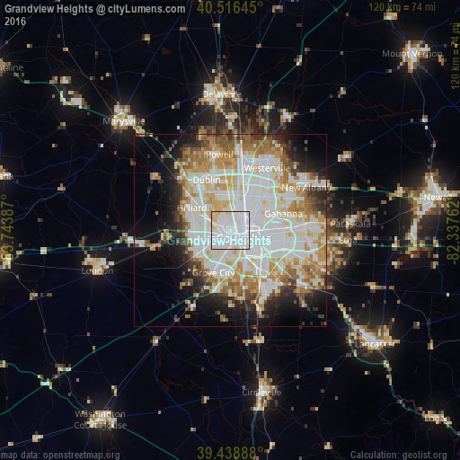
Analysis of Grandview Heights night lights 2016
Square area 10x10 km:
 70.24%
90-99
21.43%80-89
7.65%70-79
0.68%60-69
0%50-59
0%40-49
0%30-39
0%20-29
0%10-19
0%0-9
0%Square area 50x50 km:
16.58%90-99
14.62%80-89
5.52%70-79
6.11%60-69
6.12%50-59
4.5%40-49
3.44%30-39
3.67%20-29
5.76%10-19
8.63%0-9
25.06%Clear (daylight) street map image can be seen on geolist.org.
Map coordinates:
40° 30' 59.2" North, 83° 44' 37.9" West
39° 58' 47.2" North, 83° 2' 26.7" West
39° 26' 20" North, 82° 20' 15.4" West
Some cities around Grandview Heights sort by population:
• Columbus
4.1 km =2.5 mi,  120°
120°
• Grove City
11.8 km =7.3 mi,  202°
202°
• Upper Arlington
2.5 km =1.6 mi,  311°
311°
• Hilliard
11.6 km =7.2 mi,  300°
300°
• Whitehall
13.3 km =8.3 mi,  96°
96°
• Worthington
12.7 km =7.9 mi,  8°
8°
• Bexley
8.9 km =5.5 mi, 97°
• Lincoln Village
8.2 km =5.1 mi,  250°
250°
4513057 (p: 7,328)
Sources (retrieved 2019-11-25):
» Earth at Night: Flat Maps 2012, 2016