Portland night lights from space
Night Light of Portland (Oregon) from space (United States) Src. Average luminocity for 10x10km area is 90.1424% and for 50x50km: 47.3591%.
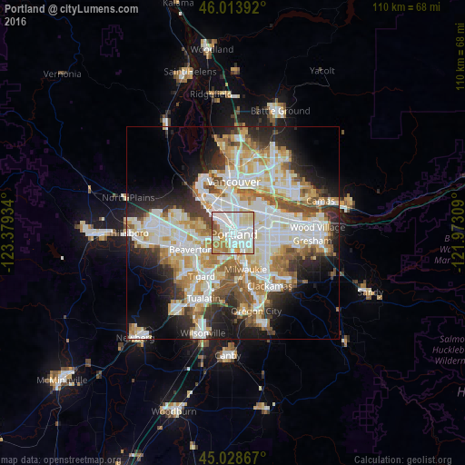

Analysis of Portland night lights 2016
Square area 10x10 km:
 33.48%
90-99
32.42%80-89
13.48%70-79
7.73%60-69
9.7%50-59
2.12%40-49
1.06%30-39
0%20-29
0%10-19
0%0-9
0%Square area 50x50 km:
12.44%90-99
12.81%80-89
5.72%70-79
6.2%60-69
5.77%50-59
4.79%40-49
3.7%30-39
3.88%20-29
7.53%10-19
10.02%0-9
27.16%Clear (daylight) street map image can be seen on geolist.org.
Map coordinates:
46° 0' 50.1" North, 123° 22' 45.6" West
45° 31' 24.4" North, 122° 40' 34.4" West
45° 1' 43.2" North, 121° 58' 23.1" West
Some cities around Portland sort by population:
• Milwaukie
9.1 km =5.7 mi,  161°
161°
• Cedar Hills
9.7 km =6 mi,  257°
257°
• West Haven-Sylvan
7.2 km =4.5 mi, 263°
• Kenton
6.5 km =4 mi,  356°
356°
• Garden Home-Whitford
9.2 km =5.7 mi,  224°
224°
• West Slope
7.4 km =4.6 mi,  248°
248°
• West Haven
7.3 km =4.5 mi, 264°
• Raleigh Hills
8.2 km =5.1 mi,  234°
234°
5746545 (p: 632,309)
Sources (retrieved 2019-11-25):
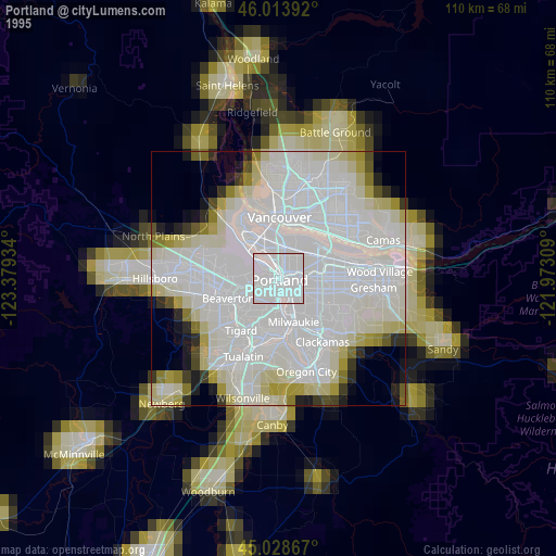
» NASA, Earths city lights 1995
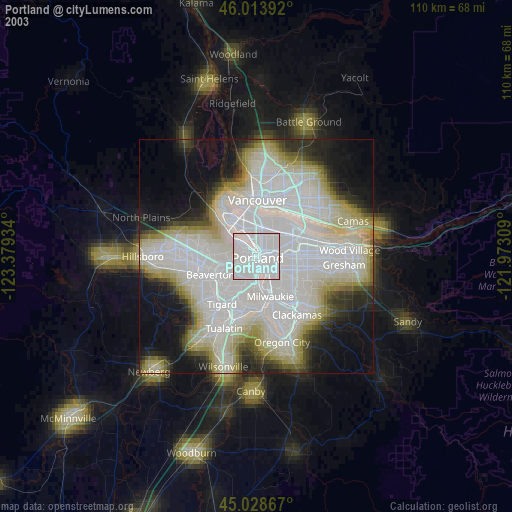
» NASA city lights 2003
» Earth at Night: Flat Maps 2012, 2016