Kenton night lights from space
Night Light of Kenton (Oregon) from space (United States) Src. Average luminocity for 10x10km area is 89.1576% and for 50x50km: 45.6486%.
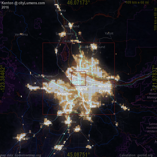
Analysis of Kenton night lights 2016
Square area 10x10 km:
 32.12%
90-99
34.24%80-89
13.18%70-79
6.67%60-69
4.7%50-59
5.3%40-49
3.64%30-39
0.15%20-29
0%10-19
0%0-9
0%Square area 50x50 km:
12.08%90-99
12.45%80-89
5.59%70-79
6.03%60-69
5.49%50-59
4.54%40-49
3.69%30-39
3.5%20-29
6.75%10-19
8.84%0-9
31.05%Clear (daylight) street map image can be seen on geolist.org.
Map coordinates:
46° 4' 18.2" North, 123° 23' 4.6" West
45° 34' 54.4" North, 122° 40' 53.4" West
45° 5' 15" North, 121° 58' 42.1" West
Some cities around Kenton sort by population:
• Portland
6.5 km =4 mi,  176°
176°
• Vancouver
6.5 km =4 mi,  13°
13°
• Hazel Dell
10.1 km =6.3 mi, 8°
• Minnehaha
9 km =5.6 mi,  16°
16°
• West Haven-Sylvan
9.9 km =6.2 mi,  222°
222°
• North Portland
3.6 km =2.2 mi,  331°
331°
• West Slope
11.3 km =7 mi, 215°
• West Haven
9.9 km =6.2 mi, 223°
5734860 (p: 7,000)
Sources (retrieved 2019-11-25):
» Earth at Night: Flat Maps 2012, 2016