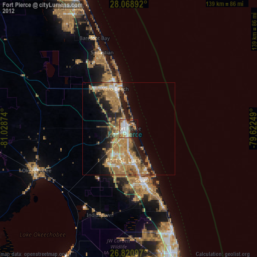
Fort Pierce night lights from space
Night Light of Fort Pierce (Florida) from space (United States) Src. Average luminocity for 10x10km area is 65.7443% and for 50x50km: 23.0916%.
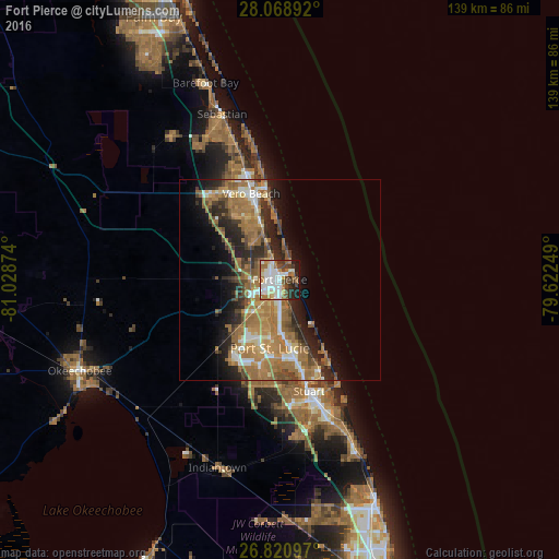
Analysis of Fort Pierce night lights 2016
Square area 10x10 km:
 17.23%
90-99
17.61%80-89
4.55%70-79
5.87%60-69
16.1%50-59
6.06%40-49
9.28%30-39
5.11%20-29
9.09%10-19
8.9%0-9
0.19%Square area 50x50 km:
2.42%90-99
3.07%80-89
1.79%70-79
3.05%60-69
9.72%50-59
4.14%40-49
3.1%30-39
2.82%20-29
5.99%10-19
7.18%0-9
56.72%Clear (daylight) street map image can be seen on geolist.org.
Map coordinates:
28° 4' 8.1" North, 81° 1' 43.5" West
27° 26' 48.2" North, 80° 19' 32.2" West
26° 49' 15.5" North, 79° 37' 21" West
Some cities around Fort Pierce sort by population:
• Port Saint Lucie
17.2 km =10.7 mi,  188°
188°
• Vero Beach South
20.7 km =12.9 mi,  335°
335°
• Florida Ridge
16 km =9.9 mi, 337°
• Vero Beach
22.5 km =14 mi, 341°
• Lakewood Park
13.1 km =8.1 mi,  324°
324°
• Indian River Estates
9.3 km =5.8 mi,  170°
170°
• River Park
14.9 km =9.3 mi, 188°
• Hutchinson Island South
19.4 km =12.1 mi,  147°
147°
4156018 (p: 44,484)
Sources (retrieved 2019-11-25):
» Earth at Night: Flat Maps 2012, 2016