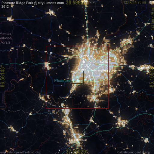
Pleasure Ridge Park night lights from space
Night Light of Pleasure Ridge Park (Kentucky) from space (United States) Src. Average luminocity for 10x10km area is 82.0476% and for 50x50km: 38.7892%.
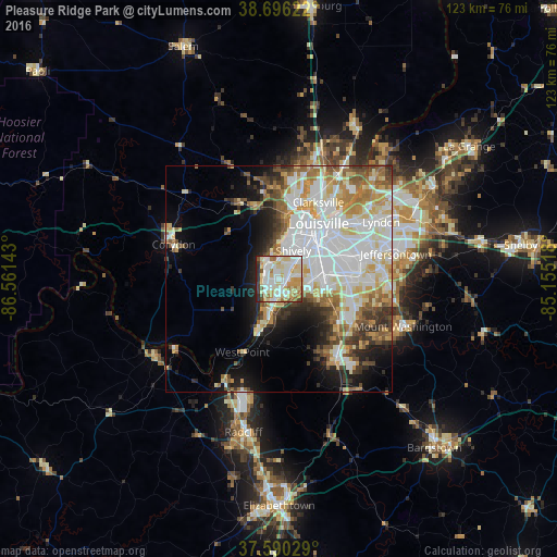
Analysis of Pleasure Ridge Park night lights 2016
Square area 10x10 km:
 20.92%
90-99
29.25%80-89
19.22%70-79
8.84%60-69
7.14%50-59
2.72%40-49
2.38%30-39
3.4%20-29
5.95%10-19
0.17%0-9
0%Square area 50x50 km:
11.47%90-99
9.52%80-89
5.25%70-79
4.33%60-69
4.37%50-59
3.58%40-49
3.45%30-39
3.58%20-29
4.29%10-19
7.47%0-9
42.69%Clear (daylight) street map image can be seen on geolist.org.
Map coordinates:
38° 41' 46.4" North, 86° 33' 41.1" West
38° 8' 43.3" North, 85° 51' 29.9" West
37° 35' 25" North, 85° 9' 18.6" West
Some cities around Pleasure Ridge Park sort by population:
• Louisville
14.9 km =9.3 mi,  35°
35°
• New Albany
15.9 km =9.9 mi,  10°
10°
• Valley Station
3.9 km =2.4 mi,  195°
195°
• Okolona
14.9 km =9.3 mi,  91°
91°
• Shively
6.8 km =4.2 mi,  27°
27°
• Saint Dennis
4.9 km =3 mi, 12°
• Fairdale
9.8 km =6.1 mi,  117°
117°
• Hillview
17.3 km =10.7 mi, 119°
4304713 (p: 25,813)
Sources (retrieved 2019-11-25):
» Earth at Night: Flat Maps 2012, 2016