Alpine night lights from space
Night Light of Alpine (Utah) from space (United States) Src. Average luminocity for 10x10km area is 34.1718% and for 50x50km: 31.2339%.
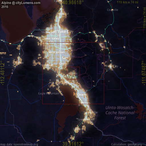
Analysis of Alpine night lights 2016
Square area 10x10 km:
 0.85%
0.85%90-99
1.87%80-89
1.7%70-79
2.89%60-69
6.8%50-59
17.86%40-49
11.56%30-39
2.89%20-29
17.18%10-19
18.37%0-9
18.03%Square area 50x50 km:
6.85%90-99
7.51%80-89
5.27%70-79
3.93%60-69
3.8%50-59
3.93%40-49
2.33%30-39
2.89%20-29
5.95%10-19
7.39%0-9
50.14%Clear (daylight) street map image can be seen on geolist.org.
Map coordinates:
40° 59' 10.2" North, 112° 28' 52" West
40° 27' 11.8" North, 111° 46' 40.8" West
39° 54' 58" North, 111° 4' 29.5" West
Some cities around Alpine sort by population:
• Lehi
9.2 km =5.7 mi,  221°
221°
• Draper
10.8 km =6.7 mi,  317°
317°
• Pleasant Grove
10.5 km =6.5 mi,  161°
161°
• American Fork
8.6 km =5.3 mi,  190°
190°
• Highland
3.4 km =2.1 mi,  204°
204°
• Bluffdale
14.2 km =8.8 mi,  286°
286°
• Lindon
13.2 km =8.2 mi, 158°
• Cedar Hills
4.7 km =2.9 mi, 159°
5770732 (p: 10,235)
Sources (retrieved 2019-11-25):
» Earth at Night: Flat Maps 2012, 2016