Saratoga Springs night lights from space
Night Light of Saratoga Springs (Utah) from space (United States) Src. Average luminocity for 10x10km area is 33.7228% and for 50x50km: 23.7036%.
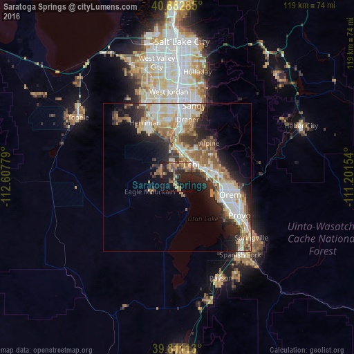
Analysis of Saratoga Springs night lights 2016
Square area 10x10 km:
 1.02%
1.02%90-99
0.68%80-89
5.78%70-79
7.31%60-69
6.46%50-59
9.18%40-49
4.59%30-39
5.44%20-29
15.82%10-19
29.93%0-9
13.78%Square area 50x50 km:
4.4%90-99
4.74%80-89
3.36%70-79
3.14%60-69
3.44%50-59
3.74%40-49
2.49%30-39
2.85%20-29
6.06%10-19
8.06%0-9
57.72%Clear (daylight) street map image can be seen on geolist.org.
Map coordinates:
40° 52' 58.3" North, 112° 36' 28" West
40° 20' 56.8" North, 111° 54' 16.8" West
39° 48' 40.1" North, 111° 12' 5.5" West
Some cities around Saratoga Springs sort by population:
• Lehi
6.6 km =4.1 mi,  44°
44°
• Pleasant Grove
14.2 km =8.8 mi,  83°
83°
• American Fork
9.7 km =6 mi,  71°
71°
• Eagle Mountain
9.5 km =5.9 mi,  245°
245°
• Highland
12.6 km =7.8 mi,  47°
47°
• Lindon
15.6 km =9.7 mi,  92°
92°
• Cedar Hills
14.3 km =8.9 mi,  59°
59°
• Alpine
15.8 km =9.8 mi, 42°
5781087 (p: 25,407)
Sources (retrieved 2019-11-25):
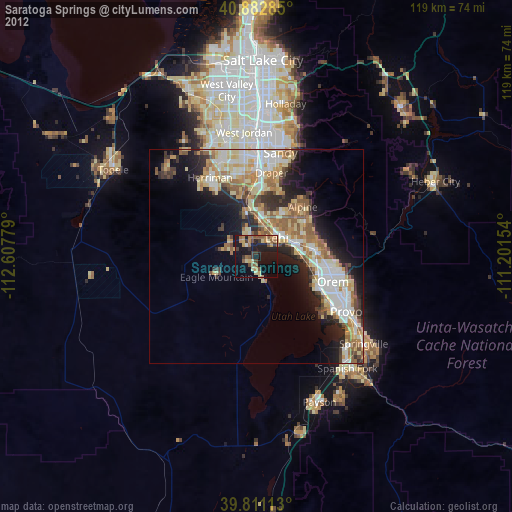
» Earth at Night: Flat Maps 2012, 2016