Plaistow night lights from space
Night Light of Plaistow (New Hampshire) from space (United States) Src. Average luminocity for 10x10km area is 34.1365% and for 50x50km: 26.6019%.
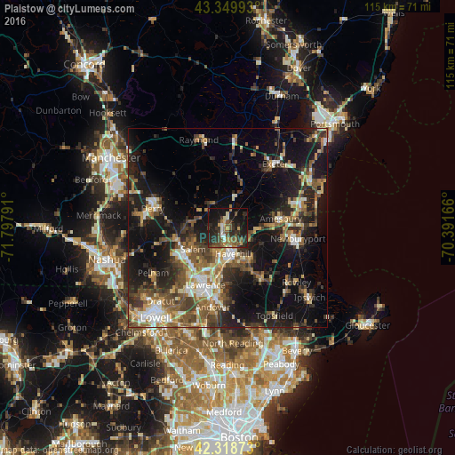
Analysis of Plaistow night lights 2016
Square area 10x10 km:
 1.75%
1.75%90-99
3.17%80-89
2.38%70-79
3.17%60-69
5.4%50-59
10.48%40-49
7.46%30-39
7.14%20-29
19.84%10-19
33.02%0-9
6.19%Square area 50x50 km:
2.63%90-99
3.61%80-89
2.9%70-79
3.14%60-69
3.9%50-59
5.29%40-49
4.99%30-39
4.87%20-29
9.24%10-19
19.83%0-9
39.6%Clear (daylight) street map image can be seen on geolist.org.
Map coordinates:
43° 20' 59.7" North, 71° 47' 52.5" West
42° 50' 11.3" North, 71° 5' 41.2" West
42° 19' 7.4" North, 70° 23' 30" West
Some cities around Plaistow sort by population:
• Haverhill
6.9 km =4.3 mi,  167°
167°
• Salem
10.2 km =6.3 mi,  238°
238°
• Hampstead
8.2 km =5.1 mi,  300°
300°
• Atkinson
4.3 km =2.7 mi,  272°
272°
• Merrimac
7.6 km =4.7 mi,  94°
94°
• Kingston
11.6 km =7.2 mi,  16°
16°
• Groveland
9.9 km =6.2 mi,  148°
148°
• Sandown
12.7 km =7.9 mi,  323°
323°
5091273 (p: 7,885)
Sources (retrieved 2019-11-25):
» Earth at Night: Flat Maps 2012, 2016