Sandown night lights from space
Night Light of Sandown (New Hampshire) from space (United States) Src. Average luminocity for 10x10km area is 3.0048% and for 50x50km: 23.6216%.
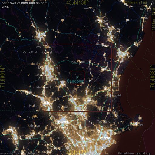
Analysis of Sandown night lights 2016
Square area 10x10 km:
 0%
0%90-99
0%80-89
0%70-79
0%60-69
0.63%50-59
0.63%40-49
0%30-39
1.9%20-29
2.06%10-19
0.79%0-9
93.97%Square area 50x50 km:
2.67%90-99
3.47%80-89
2.63%70-79
2.88%60-69
3.45%50-59
4.35%40-49
3.96%30-39
3.82%20-29
8.21%10-19
17.37%0-9
47.18%Clear (daylight) street map image can be seen on geolist.org.
Map coordinates:
43° 26' 29" North, 71° 53' 24.5" West
42° 55' 43.3" North, 71° 11' 13.2" West
42° 24' 42.2" North, 70° 29' 2" West
Some cities around Sandown sort by population:
• Derry Village
11 km =6.8 mi,  248°
248°
• Salem
15.6 km =9.7 mi,  184°
184°
• Derry
12.6 km =7.8 mi,  244°
244°
• Hampstead
6 km =3.7 mi, 175°
• Plaistow
12.7 km =7.9 mi,  143°
143°
• Atkinson
10.6 km =6.6 mi,  162°
162°
• Kingston
10.9 km =6.8 mi,  85°
85°
• Chester
6.5 km =4 mi,  298°
298°
5092364 (p: 5,827)
Sources (retrieved 2019-11-25):
» Earth at Night: Flat Maps 2012, 2016