Brentwood night lights from space
Night Light of Brentwood (Pennsylvania) from space (United States) Src. Average luminocity for 10x10km area is 85.6395% and for 50x50km: 55.1659%.
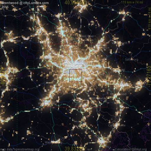
Analysis of Brentwood night lights 2016
Square area 10x10 km:
 21.6%
21.6%90-99
25.51%80-89
13.78%70-79
22.11%60-69
15.82%50-59
1.19%40-49
0%30-39
0%20-29
0%10-19
0%0-9
0%Square area 50x50 km:
9.03%90-99
10.13%80-89
6.63%70-79
7.84%60-69
11.44%50-59
12.29%40-49
9.33%30-39
7.19%20-29
10.15%10-19
9.91%0-9
6.07%Clear (daylight) street map image can be seen on geolist.org.
Map coordinates:
40° 54' 15.1" North, 80° 40' 40.4" West
40° 22' 14.3" North, 79° 58' 29.2" West
39° 49' 58.1" North, 79° 16' 17.9" West
Some cities around Brentwood sort by population:
• Mount Lebanon
6.6 km =4.1 mi,  254°
254°
• Bethel Park
7.3 km =4.5 mi,  228°
228°
• Baldwin
3.6 km =2.2 mi,  185°
185°
• Whitehall
1.7 km =1.1 mi, 232°
• Munhall
6.8 km =4.2 mi,  69°
69°
• Dormont
5.7 km =3.5 mi,  299°
299°
• Pleasant Hills
4.1 km =2.5 mi,  162°
162°
• Castle Shannon
4.1 km =2.5 mi,  260°
260°
5181553 (p: 9,512)
Sources (retrieved 2019-11-25):
» Earth at Night: Flat Maps 2012, 2016