Piqua night lights from space
Night Light of Piqua (Ohio) from space (United States) Src. Average luminocity for 10x10km area is 43.7711% and for 50x50km: 10.1707%.
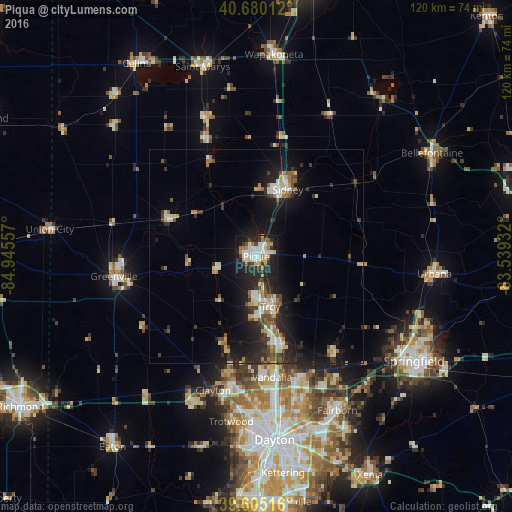

Analysis of Piqua night lights 2016
Square area 10x10 km:
 8.12%
8.12%90-99
11.2%80-89
2.27%70-79
7.63%60-69
4.87%50-59
1.95%40-49
2.44%30-39
8.93%20-29
17.21%10-19
33.28%0-9
2.11%Square area 50x50 km:
1.15%90-99
1.68%80-89
0.99%70-79
1.1%60-69
1.19%50-59
1.01%40-49
1.32%30-39
1.78%20-29
3.83%10-19
9.19%0-9
76.77%Clear (daylight) street map image can be seen on geolist.org.
Map coordinates:
40° 40' 48.4" North, 84° 56' 44.1" West
40° 8' 41.2" North, 84° 14' 32.8" West
39° 36' 18.6" North, 83° 32' 21.6" West
Some cities around Piqua sort by population:
• Troy
12.2 km =7.6 mi,  164°
164°
• Sidney
17.2 km =10.7 mi,  25°
25°
• Vandalia
28.5 km =17.7 mi,  172°
172°
• Englewood
30.1 km =18.7 mi,  189°
189°
• Clayton
32.9 km =20.4 mi,  197°
197°
• Tipp City
21.6 km =13.4 mi, 163°
• Union
28 km =17.4 mi, 191°
• New Carlisle
29.6 km =18.4 mi,  141°
141°
5166819 (p: 20,790)
Sources (retrieved 2019-11-25):
» Earth at Night: Flat Maps 2012, 2016