Pharr night lights from space
Night Light of Pharr (Texas) from space (United States) Src. Average luminocity for 10x10km area is 93.1171% and for 50x50km: 56.1306%.
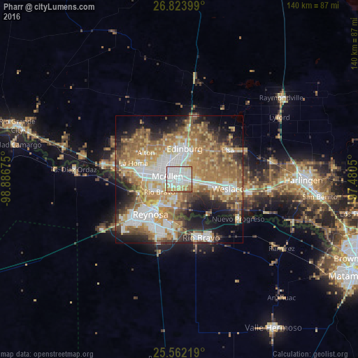
Analysis of Pharr night lights 2016
Square area 10x10 km:
 49.21%
90-99
22.02%80-89
15.67%70-79
7.14%60-69
4.17%50-59
1.79%40-49
0%30-39
0%20-29
0%10-19
0%0-9
0%Square area 50x50 km:
11.27%90-99
9.42%80-89
9.24%70-79
9.63%60-69
12.12%50-59
9.75%40-49
5.37%30-39
4.69%20-29
7.02%10-19
10.44%0-9
11.04%Clear (daylight) street map image can be seen on geolist.org.
Map coordinates:
26° 49' 26.4" North, 98° 53' 12.3" West
26° 11' 41.3" North, 98° 11' 1" West
25° 33' 43.9" North, 97° 28' 49.8" West
Some cities around Pharr sort by population:
• McAllen
4.7 km =2.9 mi,  281°
281°
• Edinburg
12.1 km =7.5 mi,  9°
9°
• San Juan
2.9 km =1.8 mi,  102°
102°
• Alamo
6.2 km =3.9 mi, 101°
• Donna
13.4 km =8.3 mi, 101°
• Hidalgo
13.2 km =8.2 mi,  217°
217°
• Murillo Colonia
9.8 km =6.1 mi,  45°
45°
• Nurillo
10.1 km =6.3 mi,  37°
37°
4718721 (p: 76,538)
Sources (retrieved 2019-11-25):
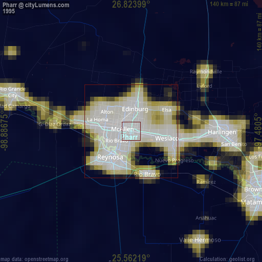
» NASA, Earths city lights 1995
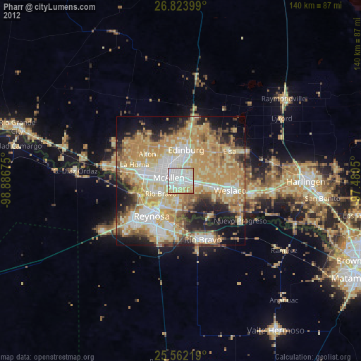
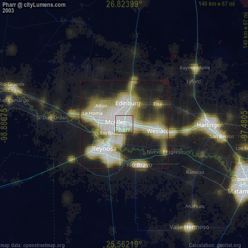
» NASA city lights 2003
» Earth at Night: Flat Maps 2012, 2016