Nurillo night lights from space
Night Light of Nurillo (Texas) from space (United States) Src. Average luminocity for 10x10km area is 79.8115% and for 50x50km: 47.2388%.
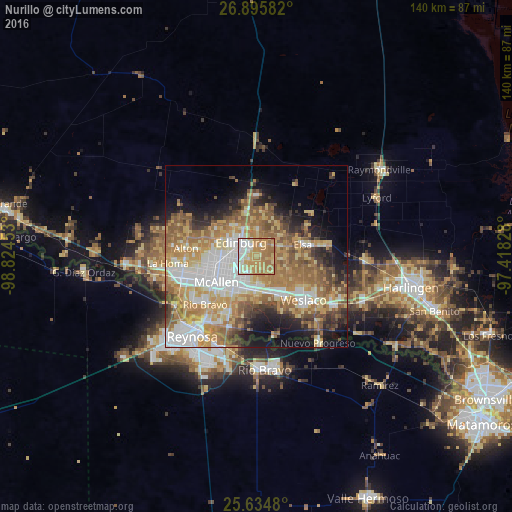
Analysis of Nurillo night lights 2016
Square area 10x10 km:
 13.89%
90-99
14.48%80-89
18.25%70-79
23.41%60-69
29.17%50-59
0.79%40-49
0%30-39
0%20-29
0%10-19
0%0-9
0%Square area 50x50 km:
9.25%90-99
7.58%80-89
8.04%70-79
8.57%60-69
10.7%50-59
7.97%40-49
4.49%30-39
3.73%20-29
4.95%10-19
8.97%0-9
25.75%Clear (daylight) street map image can be seen on geolist.org.
Map coordinates:
26° 53' 45" North, 98° 49' 28.3" West
26° 16' 1.3" North, 98° 7' 17" West
25° 38' 5.3" North, 97° 25' 5.8" West
Some cities around Nurillo sort by population:
• McAllen
12.9 km =8 mi,  236°
236°
• Edinburg
5.7 km =3.5 mi,  312°
312°
• Pharr
10.1 km =6.3 mi,  217°
217°
• San Juan
9.3 km =5.8 mi,  201°
201°
• Alamo
9.3 km =5.8 mi,  181°
181°
• Donna
12.8 km =8 mi,  147°
147°
• Murillo Colonia
1.4 km =0.9 mi, 145°
• Elsa
13.1 km =8.1 mi,  77°
77°
4715696 (p: 5,547)
Sources (retrieved 2019-11-25):
» Earth at Night: Flat Maps 2012, 2016