McAllen night lights from space
Night Light of McAllen (Texas) from space (United States) Src. Average luminocity for 10x10km area is 96.3929% and for 50x50km: 53.8562%.
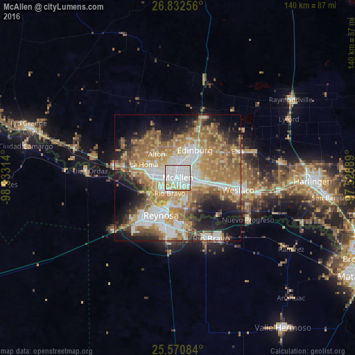
Analysis of McAllen night lights 2016
Square area 10x10 km:
 61.9%
61.9%90-99
22.42%80-89
9.13%70-79
6.55%60-69
0%50-59
0%40-49
0%30-39
0%20-29
0%10-19
0%0-9
0%Square area 50x50 km:
11.14%90-99
9.06%80-89
8.57%70-79
9.21%60-69
11.39%50-59
9.21%40-49
4.91%30-39
4.36%20-29
7.14%10-19
10.97%0-9
14.03%Clear (daylight) street map image can be seen on geolist.org.
Map coordinates:
26° 49' 57.2" North, 98° 55' 59.3" West
26° 12' 12.3" North, 98° 13' 48" West
25° 34' 15" North, 97° 31' 36.8" West
Some cities around McAllen sort by population:
• Edinburg
12.8 km =8 mi,  31°
31°
• Mission
9.6 km =6 mi,  278°
278°
• Pharr
4.7 km =2.9 mi,  101°
101°
• San Juan
7.6 km =4.7 mi, 101°
• Alamo
10.9 km =6.8 mi, 101°
• Alton
12.5 km =7.8 mi,  318°
318°
• Hidalgo
11.9 km =7.4 mi,  196°
196°
• Alton North (historical)
12.6 km =7.8 mi, 324°
4709796 (p: 140,269)
Sources (retrieved 2019-11-25):
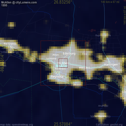
» NASA, Earths city lights 1995
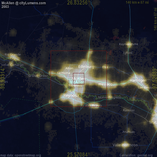
» NASA city lights 2003
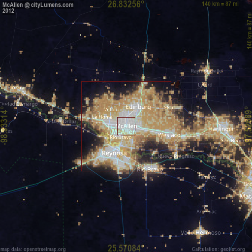
» Earth at Night: Flat Maps 2012, 2016