Edinburg night lights from space
Night Light of Edinburg (Texas) from space (United States) Src. Average luminocity for 10x10km area is 88.1052% and for 50x50km: 45.1005%.
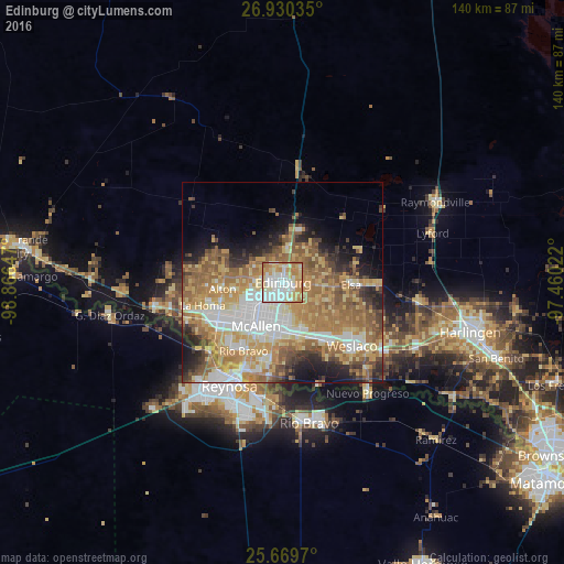
Analysis of Edinburg night lights 2016
Square area 10x10 km:
 28.57%
90-99
26.59%80-89
17.66%70-79
14.09%60-69
12.1%50-59
0.99%40-49
0%30-39
0%20-29
0%10-19
0%0-9
0%Square area 50x50 km:
8.26%90-99
6.85%80-89
7.97%70-79
8.34%60-69
10.9%50-59
8.29%40-49
4.17%30-39
3.59%20-29
4.98%10-19
7.29%0-9
29.37%Clear (daylight) street map image can be seen on geolist.org.
Map coordinates:
26° 55' 49.3" North, 98° 51' 59.3" West
26° 18' 6.3" North, 98° 9' 48" West
25° 40' 10.9" North, 97° 27' 36.8" West
Some cities around Edinburg sort by population:
• McAllen
12.8 km =8 mi,  211°
211°
• Pharr
12.1 km =7.5 mi,  189°
189°
• San Juan
12.5 km =7.8 mi,  176°
176°
• Alamo
13.7 km =8.5 mi,  162°
162°
• Alton
15 km =9.3 mi,  263°
263°
• Murillo Colonia
7.1 km =4.4 mi,  135°
135°
• Nurillo
5.7 km =3.5 mi,  132°
132°
• Alton North (historical)
14.1 km =8.8 mi,  267°
267°
4688275 (p: 84,497)
Sources (retrieved 2019-11-25):
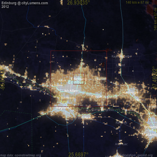
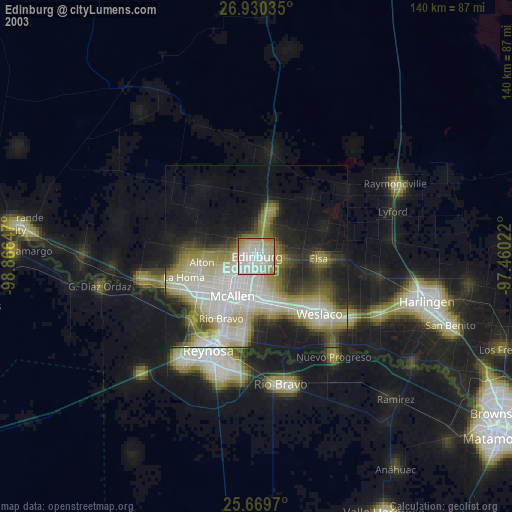
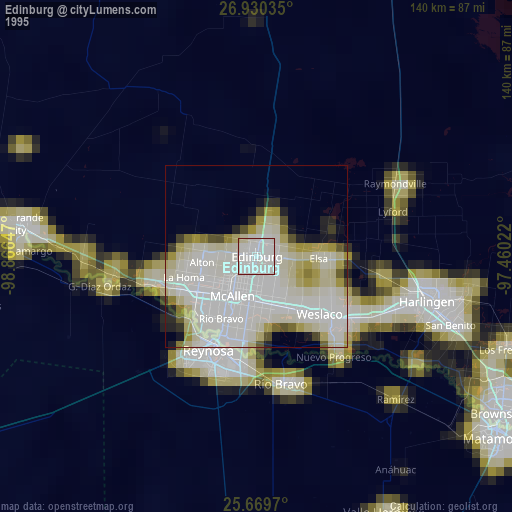
» NASA, Earths city lights 1995
» NASA city lights 2003
» Earth at Night: Flat Maps 2012, 2016