Petaluma night lights from space
Night Light of Petaluma (California) from space (United States) Src. Average luminocity for 10x10km area is 35.1752% and for 50x50km: 9.4655%.
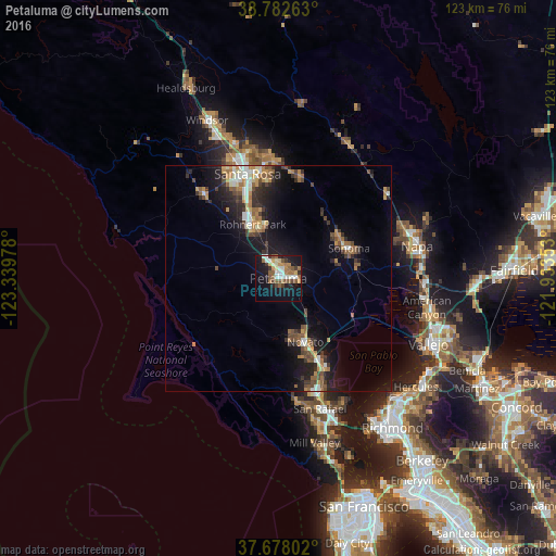
Analysis of Petaluma night lights 2016
Square area 10x10 km:
 5.61%
5.61%90-99
5.78%80-89
2.55%70-79
4.76%60-69
5.95%50-59
9.69%40-49
3.4%30-39
3.74%20-29
2.89%10-19
31.97%0-9
23.64%Square area 50x50 km:
0.95%90-99
1.22%80-89
0.61%70-79
1.37%60-69
1.65%50-59
1.53%40-49
1.53%30-39
1.84%20-29
2.17%10-19
8.11%0-9
79.02%Clear (daylight) street map image can be seen on geolist.org.
Map coordinates:
38° 46' 57.5" North, 123° 20' 23.2" West
38° 13' 56.7" North, 122° 38' 11.9" West
37° 40' 40.9" North, 121° 56' 0.7" West
Some cities around Petaluma sort by population:
• Santa Rosa
24.1 km =15 mi,  343°
343°
• Novato
15.1 km =9.4 mi,  157°
157°
• Rohnert Park
13.2 km =8.2 mi,  334°
334°
• Sonoma
16.9 km =10.5 mi,  67°
67°
• Cotati
12.2 km =7.6 mi, 329°
• Boyes Hot Springs
16.3 km =10.1 mi,  56°
56°
• Roseland
22.5 km =14 mi, 339°
• Lucas Valley-Marinwood
22 km =13.7 mi,  165°
165°
5382232 (p: 60,438)
Sources (retrieved 2019-11-25):
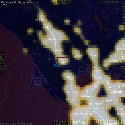
» NASA, Earths city lights 1995
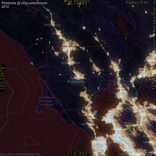
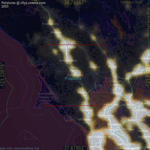
» NASA city lights 2003
» Earth at Night: Flat Maps 2012, 2016