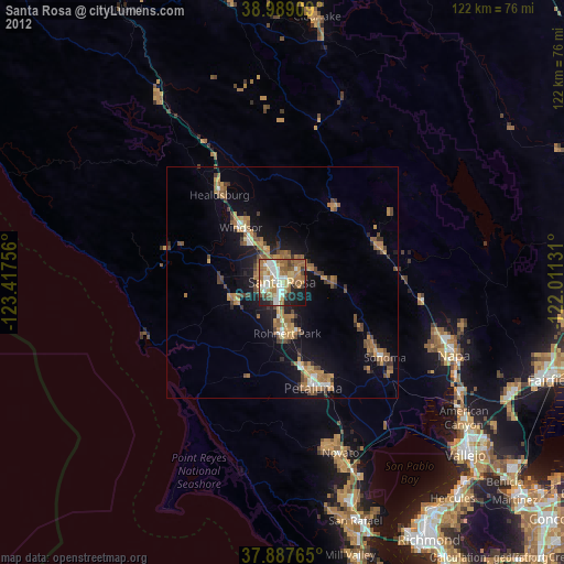
Santa Rosa night lights from space
Night Light of Santa Rosa (California) from space (United States) Src. Average luminocity for 10x10km area is 68.513% and for 50x50km: 10.8429%.

Analysis of Santa Rosa night lights 2016
Square area 10x10 km:
 12.99%
90-99
16.72%80-89
6.49%70-79
12.5%60-69
15.26%50-59
13.15%40-49
7.95%30-39
5.03%20-29
7.79%10-19
2.11%0-9
0%Square area 50x50 km:
1.09%90-99
1.38%80-89
0.69%70-79
2.06%60-69
1.95%50-59
1.87%40-49
1.51%30-39
2.09%20-29
2.62%10-19
7.98%0-9
76.76%Clear (daylight) street map image can be seen on geolist.org.
Map coordinates:
38° 59' 20.7" North, 123° 25' 3.2" West
38° 26' 25.7" North, 122° 42' 51.9" West
37° 53' 15.5" North, 122° 0' 40.7" West
Some cities around Santa Rosa sort by population:
• Rohnert Park
11.3 km =7 mi,  174°
174°
• Windsor
14.8 km =9.2 mi,  323°
323°
• Larkfield-Wikiup
8.7 km =5.4 mi,  338°
338°
• Sebastopol
10.4 km =6.5 mi,  245°
245°
• Cotati
12.6 km =7.8 mi,  177°
177°
• Roseland
2.4 km =1.5 mi,  210°
210°
• Saint Helena
22.4 km =13.9 mi,  71°
71°
• Calistoga
19.3 km =12 mi,  37°
37°
5393287 (p: 174,972)
Sources (retrieved 2019-11-25):
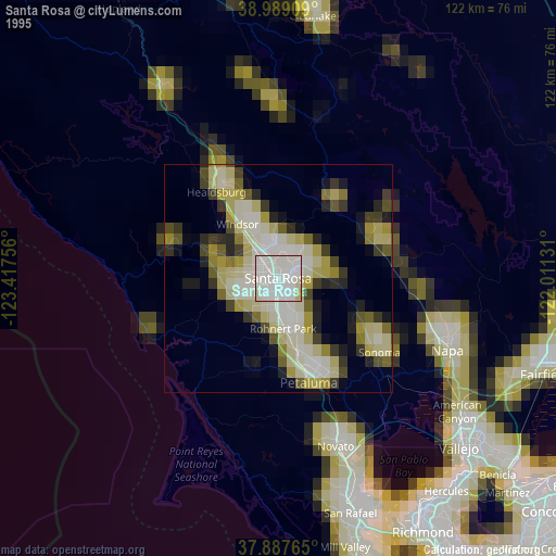
» NASA, Earths city lights 1995
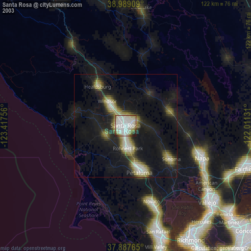
» NASA city lights 2003
» Earth at Night: Flat Maps 2012, 2016