Novato night lights from space
Night Light of Novato (California) from space (United States) Src. Average luminocity for 10x10km area is 28.1023% and for 50x50km: 14.0049%.
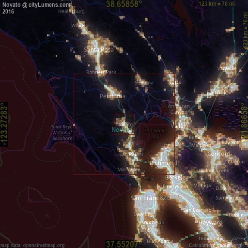
Analysis of Novato night lights 2016
Square area 10x10 km:
 2.6%
2.6%90-99
2.44%80-89
0.81%70-79
3.41%60-69
7.14%50-59
5.84%40-49
8.6%30-39
5.19%20-29
3.73%10-19
27.44%0-9
32.79%Square area 50x50 km:
1.99%90-99
1.95%80-89
0.75%70-79
1.89%60-69
2.08%50-59
2.47%40-49
2.52%30-39
2.47%20-29
3.47%10-19
12.16%0-9
68.24%Clear (daylight) street map image can be seen on geolist.org.
Map coordinates:
38° 39' 30.9" North, 123° 16' 22.2" West
38° 6' 26.7" North, 122° 34' 10.9" West
37° 33' 7.5" North, 121° 51' 59.7" West
Some cities around Novato sort by population:
• Petaluma
15.1 km =9.4 mi,  337°
337°
• San Rafael
15.3 km =9.5 mi,  167°
167°
• San Anselmo
14.8 km =9.2 mi,  177°
177°
• Larkspur
19.5 km =12.1 mi, 171°
• Corte Madera
20.6 km =12.8 mi, 169°
• Fairfax
13.5 km =8.4 mi,  187°
187°
• Kentfield
17.3 km =10.7 mi, 176°
• Lucas Valley-Marinwood
7.5 km =4.7 mi, 183°
5378044 (p: 55,530)
Sources (retrieved 2019-11-25):
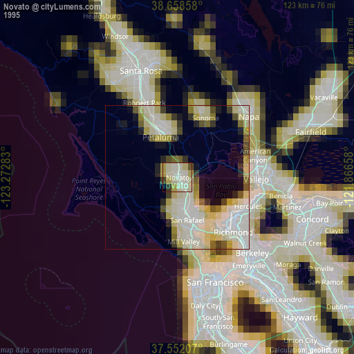
» NASA, Earths city lights 1995
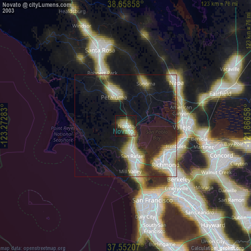
» NASA city lights 2003
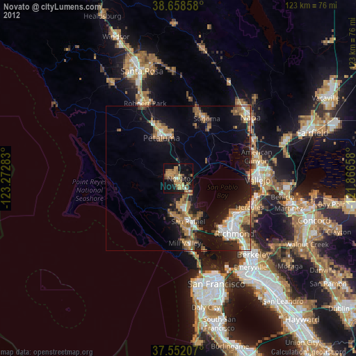
» Earth at Night: Flat Maps 2012, 2016