Lincoln night lights from space
Night Light of Lincoln (Alabama) from space (United States) Src. Average luminocity for 10x10km area is 39.6172% and for 50x50km: 15.9244%.
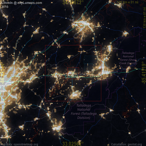
Analysis of Lincoln night lights 2016
Square area 10x10 km:
 4.21%
4.21%90-99
3.85%80-89
3.66%70-79
8.42%60-69
7.88%50-59
6.59%40-49
6.23%30-39
8.06%20-29
8.79%10-19
35.53%0-9
6.78%Square area 50x50 km:
0.72%90-99
0.86%80-89
2.14%70-79
2.5%60-69
2.44%50-59
2.49%40-49
3.03%30-39
5.38%20-29
4.87%10-19
15.26%0-9
60.32%Clear (daylight) street map image can be seen on geolist.org.
Map coordinates:
34° 11' 48.2" North, 86° 49' 17.2" West
33° 36' 47.4" North, 86° 7' 5.9" West
33° 1' 32.2" North, 85° 24' 54.7" West
Some cities around Lincoln sort by population:
• Anniston
27 km =16.8 mi,  78°
78°
• Oxford
26.2 km =16.3 mi,  89°
89°
• Talladega
19.7 km =12.2 mi,  176°
176°
• Pell City
15.8 km =9.8 mi,  259°
259°
• Moody
34.6 km =21.5 mi,  265°
265°
• Saks
27.5 km =17.1 mi,  69°
69°
• Rainbow City
38.6 km =24 mi,  10°
10°
• Southside
35.7 km =22.2 mi, 14°
4072767 (p: 6,524)
Sources (retrieved 2019-11-25):
» Earth at Night: Flat Maps 2012, 2016