Grayson Valley night lights from space
Night Light of Grayson Valley (Alabama) from space (United States) Src. Average luminocity for 10x10km area is 72.1447% and for 50x50km: 35.5119%.
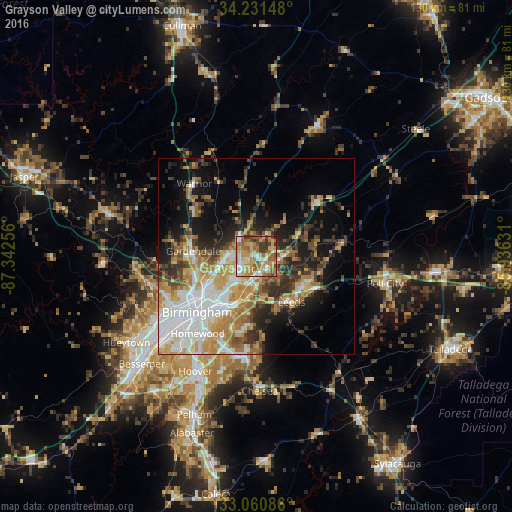
Analysis of Grayson Valley night lights 2016
Square area 10x10 km:
 10.44%
90-99
11.36%80-89
14.47%70-79
19.6%60-69
19.05%50-59
11.72%40-49
5.49%30-39
7.69%20-29
0.18%10-19
0%0-9
0%Square area 50x50 km:
7.9%90-99
5.51%80-89
4.79%70-79
6.35%60-69
5.73%50-59
3.57%40-49
4.1%30-39
5.13%20-29
6.68%10-19
11.62%0-9
38.63%Clear (daylight) street map image can be seen on geolist.org.
Map coordinates:
34° 13' 53.3" North, 87° 20' 33.2" West
33° 38' 53.4" North, 86° 38' 21.9" West
33° 3' 39.1" North, 85° 56' 10.7" West
Some cities around Grayson Valley sort by population:
• Dixiana
10.3 km =6.4 mi,  354°
354°
• Trussville
4.2 km =2.6 mi,  138°
138°
• Center Point
4.1 km =2.5 mi,  266°
266°
• Irondale
13.7 km =8.5 mi,  207°
207°
• Leeds
14.2 km =8.8 mi, 141°
• Clay
7.1 km =4.4 mi,  31°
31°
• Pinson
6.1 km =3.8 mi,  318°
318°
• Tarrant
14.3 km =8.9 mi,  239°
239°
4065029 (p: 5,736)
Sources (retrieved 2019-11-25):
» Earth at Night: Flat Maps 2012, 2016