Burbank night lights from space
Night Light of Burbank (Illinois) from space (United States) Src. Average luminocity for 10x10km area is 99.4188% and for 50x50km: 83.9864%.

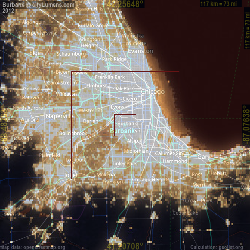
Analysis of Burbank night lights 2016
Square area 10x10 km:
 81.66%
90-99
16.56%80-89
1.79%70-79
0%60-69
0%50-59
0%40-49
0%30-39
0%20-29
0%10-19
0%0-9
0%Square area 50x50 km:
42.14%90-99
19.93%80-89
9.36%70-79
8.06%60-69
6.6%50-59
4.63%40-49
1.8%30-39
1.16%20-29
0.97%10-19
1.2%0-9
4.15%Clear (daylight) street map image can be seen on geolist.org.
Map coordinates:
42° 15' 23.3" North, 88° 28' 57.5" West
41° 44' 2.1" North, 87° 46' 46.2" West
41° 12' 25.5" North, 87° 4' 35" West
Some cities around Burbank sort by population:
• Oak Lawn
3.1 km =1.9 mi,  145°
145°
• Ashburn
5.9 km =3.7 mi,  75°
75°
• Palos Hills
5.2 km =3.2 mi,  216°
216°
• Bridgeview
2.7 km =1.7 mi,  311°
311°
• Chicago Ridge
3.6 km =2.2 mi,  179°
179°
• Hickory Hills
3.9 km =2.4 mi,  256°
256°
• Justice
5 km =3.1 mi,  283°
283°
• Worth
5.1 km =3.2 mi,  196°
196°
4885983 (p: 29,128)
Sources (retrieved 2019-11-25):
» Earth at Night: Flat Maps 2012, 2016